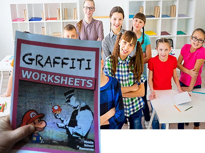
EVEN MORE printable maps with a simple clue that students use to determine what country is outlined on the sheet.
The first pack of What Country is This? was so popular, that I have made another pack
Again, the clue might be a longitude or latitude, a key city, or a geographical feature.
The task is simple, but the activity is challenging.
Students can also use the shape of the country to help in working out the name of the country.
The worksheets have an answer key at the end. There are 22 maps in all. Some sample pages shown.
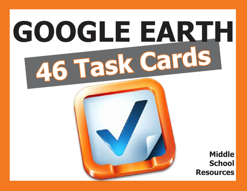
46 Task Cards with 46 activities for students to explore Google Earth.
Activities include:
- measuring distance with ruler function
- calculating area
- using longitude and latitude
- mastering Google Earth tools and applications
- understanding continents, countries
- exploring Google Sky, Moon and Mars
- zooming in to significant landmarks
- investigative work on the ground
- and much more.
Comprehensive Answer Key included.
Print out cards on to firm board - easy two-cut template to create four cards per page.
(Some samples shown)
100 plus pages of self-directing activities for the Middle School students.
Google Earth Worksheets
More than 50 pages of Blackline Masters for upper primary/lower secondary students.
All worksheet activities are completed with the fabulous Google Earth application which is free to download on to your PC or Mac from http://earth.google.com/. Activities require minimum teacher direction and provide maximum learning for the student.
• Constellation conundrum
• Landmarks
• Cruise around the world
• Help!! Endangered species
• The Galapagos Islands
• Continents
• Google Moon
• The Earth's Grid System
• Make the World a Better Place
• Mission to Mars
• Majestic Mountains
• My Google Earth Autobiography
• Mysterious Locations
• National Parks
• Ocean Explorer
• Ocean Investigations
• The Olympics
• The ABCs of Google Earth
• Bonjour, Mon Ami
______________________________________________________
Layers Reference and Activity Booklet
Google Earth has over 50 layers of information and all are explained in this booklet, along with student activities designed to allow the student to explore each of the layers and track down the type of fascinating information that can be found on each layer.
Layers are also given a value rating so that teachers can go directly to the most valuable layer with the most educational information.
The booklet includes definitions and activities around the following Google Earth layers:
• Borders and Labels
• Photos
• 3D Buildings
• Ocean
• Weather
• Gallery
• Global Awareness
• and more
Key points of interest are highlighted and quirky little tips are included.
This is a true reference book for any student or teacher who works with Google Earth.
_______________________________________________________How to Zoom and Fly
A slide show that instructs users on how to use these basic functions of Zooming and Flying around Google Earth.
Download this Powerpoint slide set to show your students how to use and practice the zooming and flying functions. Easy to follow - students could review them at their own pace.
_______________________________________________________
Longitude and Latitude Worksheets
Lesson Plan with worksheets for the Secondary classroom that teaches the principles of Longitude and Latitude using the popular Google Earth.
The worksheets are simple and self-guiding. There is an answer sheet at the end of the booklet.
The lesson takes about 3 weeks to complete and there are additional worksheets that the early finishers can work on to further extend their knowledge. Objectives included.
______________________________________________________
More Google Earth Worksheets
32 pages of printable worksheets for the Upper Primary student. Clear instructions, clear print and totally self-guiding
Use Google Earth to complete these self-directed worksheets. Easy to use and very educational.
A wide range of topics covered, including:
- Religions of the world
- Capital cities
- Deserts
- Trip planning and more
______________________________________________________
Google Earth Task Cards
46 Task Cards with 46 activities for students to explore Google Earth.
Activities include:
- measuring distance with ruler function
- calculating area
- using longitude and latitude
- mastering Google Earth tools and applications
- understanding continents, countries
- exploring Google Sky, Moon and Mars
- zooming in to significant landmarks
- investigative work on the ground
- and much more.
Comprehensive Answer Key included.
Print out cards on to firm board - easy two-cut template to create four cards per page.
****
See more here:
Middle School Resources
****
Learn more about the author at
Malcom Brown
****
100% Money Back guarantee - if there is anything at all about this pack that disappoints or was not as expected, please get back to me and your investment will be completely refunded - no issue at all.
****
Who doesn’t like the magic of city skylines? I do, and my class loves them and these worksheets on city skylines worked great.
The task here is to inspect the city skyline on each worksheet PLUS review the other clue. Then identify the name of the city.
The other clue may be figures about the city, the city’s logo or flag, a map of the city’s area, or a logo of the sporting club that is based in that city.
The task is challenging and fun, and normally requires the student to be creative in how they investigate the answer.
Do I use Google Maps?
Do I use Wikipedia?
Do I try to find the answer by identifying a building on the skyline?
The worksheets are a great library filler and you can always pull one out for that spare moment.
20 maps in all, with an Answer Key at the end. Note that the cities are all US cities.
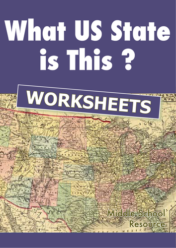
Printable maps with a simple clue that students use to determine what US State is outlined on the sheet. Best used with Google Earth.
The clue might be a longitude or latitude, a key city, or a geographical feature.
The task is simple, but the activity is challenging. And some maps involve a bit of problem solving by the student.
Students can also use the shape of the State to help in working out the name of the country.
The worksheets have an answer key at the end. There are 14 maps in all.
Representing data on a map is an important form of communicating information to the reader. Information graphics need to provide the right information in the clearest format possible. Google Maps provides an easy facility to display data for any reader, and anybody can use this facility to upload their information.
An excellent introduction to this topic would be for the teacher and students to explore the range of ways that data can be represented on a map. Different ways include heat maps, geographic stretching of continents, icons and symbols, colours and shades, bar graphs, and interactive maps.
The lessons and activities in this unit of work are for the lower and middle secondary years of schooling and focus on how to add Placemarks and how to bulk upload more than one data point to show a broader range of data.
Simple instructions and clear screenshots, along with relevant student activities make this unit of work self-instructing for every student.
14 pages
Duration 1 week.
Note that Sample pages only shown here. Full pack of 14 pages will be downloadable once purchase has been made.
Great value Activity Book of worksheets and activities using Google Maps, Google Earth and Google Street View.
Covers a wide range of topics, subject areas and skills. All self-guiding, challenging and very original.
This is a combination of all my various Google Maps packs and bundles, compiled into an updated and attractive single book of activities with an answer key.
Invest in this book, download and just share or print off whatever you need, whenever you need it.
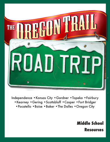
Cross country road trip that follows the original Oregon Trail across northern US, stopping in all the major towns, cities and landmarks.
Various activities to do at each site. The activities cover a range of cross-curriculum fun at each point and include maths, science, language, social studies, geography and more.
Just print and pass out.
Prerequisites: Access to Google Maps and Google Earth.
Pack also includes comprehensive Answer Key and a Checklist for parents, students or teachers to keep track of work completed
__________________________________________________
Activities include:
• Complete a distance chart • Design an archway • Judge a fair • Learn about linguistics • Write a poster ad • Apply for a job • Locate coordinates • Use longitude and latitude • Draw a fantasy map • Complete a biographic • Research an event • Brainstorm a solution • Solve a problem creatively • Calculate distances and fuel needed • and much more
__________________________________________________
The Table of Contents
• Preparation
• Route Map
• Start Your Engines
• Then and Now
• The Prairie Schooner
• Have You Forgotten Something
• City of Fountains
• You be the Judge
• Zoo Snooze
• Getting Wet
• Fairbury Bound
• Interstate 80 to Kearney
• I-80 Along the Platte River
• Straight Up and Down
• Chimney Rock Cemetery
• Speak Like a Native American
• Plains Speaking Alphabet
• Sioux Speak
• Geographic Signposts
• I Spy
• Casper
• Independence Rock
• Lander
• Pocatello
• Boise
• The Dalles
• The Columbia River
• Oregon City
________________________________________________________
This is probably the best bit of work I have ever done with my class. It took me around 4-6 weeks, because we kept exploring other things stimulated by each of the topics.
Hope others enjoy the activities and worksheets as much as we did.
Great bundle value with 5 packs all related to using Google Maps in the classroom. Each pack has student self-directed worksheets that are solved by using Google Maps.
______________________________________________________
Google Maps Worksheets
Activity Sheets for the Middle School students. Great fun solving problems using Google Maps(and Google Earth). Simple instructions but challenging activities.
I have found that the students in my class need very little instruction to complete the tasks, so long as they understand the Google Maps tools.
Google account is not required - just access to the Google Maps online.
Table of Contents
1. Creating a Travelling Distance Chart
2. Solve the Riddle
3. A Different Type of Easter Egg
4. Fantasy Island
5. Landmarks Around the World
6. Cruising the Seas
7. All about Continents
8. The Earth’s Grid System
9. From Pegman’s Point of View
10. Time & Weather Clues
11. Sites with a View
12. Home Sweet Home
13. Street View Safari
14. Who Am I?
15. National Parks
16. Your Place
17. A Mission for Agent Pegman
18. Things to do on Google Earth
19. Oddities on Google Earth
______________________________________________________
Google Maps Math Problems
This is a pack of worksheets with Math problems students can do on Google Maps. The problems cover a range of activities, but my class particularly liked the activity based on Disneyland where they had to zoom in on Street View as well as use the Earth function to mathematically calculate the number of car parks in a particular structure at Disneyland, and also calculate the commercial profitability of the car park.
This is a multi-skilled pack for Middle School students and those who have bought my other packs over the years (thank you all!) you will know that each sheet is well laid out, nicely presented and encourages the student to work independently on each activity.
As well as the Disneyland activity, the pack includes:
- designing a road trip
- searching for mathematical street names in a particular location(we found more than 10 names!)
- researching odd mathematical locations
- measuring and comparing distance
- and more
10 pages of worksheets, PLUS an answer key.
______________________________________________________
Google Street View Worksheets
24 pages of worksheets for upper primary/lower secondary students using Google's fabulous Street View, newly updated with Answer Key and further instructions for Agent Pegman.
Activities include:
- looking for animals on safari
- looking for unusual landmarks
- perform some exemplary spy work
- visit some very obscure locations
- stand right in the middle of Stonehenge, Legoland, Warwick Castle gardens and travel the slopes of Whistler
______________________________________________________
Easter Fun with Google Maps
Great worksheets for Middle School students based around the story of Easter and everything connected with Easter (Easter Eggs - chocolate and non-chocolate!, Easter Island, the Easter sites of significance, and more.)
Use Google Maps to complete the worksheets
Learning objectives include:
• Ability to calculate distances in Google Maps
• Able to load a database to Google Maps
• Ability to insert Placemarker information in Google Maps
• Ability to use creativity and imagination in developing a fantasy island
• Ability to construct a map with all key features
• Ability to locate information in Google Maps using coordinates
• Ability to apply some simple knowledge of Excel.
All the activities were great fun in my classroom, and the students could progress through them at their own pace and without too much direction.
______________________________________________________
Placemarkers in Google Maps
Representing data on a map is an important form of communicating information to the reader. Information graphics need to provide the right information in the clearest format possible. Google Maps provides an easy facility to display data for any reader, and anybody can use this facility to upload their information.
An excellent introduction to this topic would be for the teacher and students to explore the range of ways that data can be represented on a map. Different ways include heat maps, geographic stretching of continents, icons and symbols, colours and shades, bar graphs, and interactive maps.
The lessons and activities in this unit of work are for the lower and middle secondary years of schooling and focus on how to add Placemarkers and how to bulk upload more than one data point to show a broader range of data.
Simple instructions and clear screenshots, along with relevant student activities make this unit of work self-instructing for every student.
****
100% Money Back guarantee - if there is anything at all about this pack that disappoints or was not as expected, please get back to me and your investment will be completely refunded - no issue at all.
****
See more here:
Middle School Resources
****
Learn more about the author at
Malcom Brown
****
Powerpoint slides of maps with a simple clue that can be used as a class activity.
The task is to determine what country is outlined on each slide. First the country outline is shown, then click on to a single clue to help identify the country.
The clue might be a longitude or latitude, a key city, or a geographical feature. Use Google Earth to find the country from the clues provided.
The task is simple, but the activity is challenging.
Once the students identify the country from the shape and/or the clue, click on to see the answer.
There are 22 maps in all.
Slideshow sequence shows the answer at final transition.
(Sample pages only shown here)
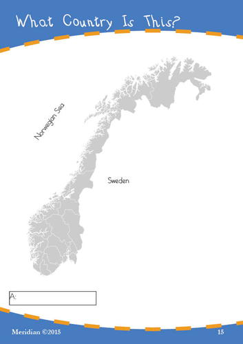
Printable maps with a simple clue that students use to determine what country is outlined on the sheet.
The clue might be a longitude or latitude, a key city, or a geographical feature.
The task is simple, but the activity is challenging.
Students can also use the shape of the country to help in working out the name of the country.
The worksheets have an answer key at the end. There are 22 maps in all. The maps shown here are samples only.
Mastering Persuasive Speech Writing (and Delivery)
Transform your students into confident, articulate speakers with this persuasive speech writing unit. Designed specifically for grades 6-8, this ready-to-use package makes creating a persuasive speech engaging, structured, and achievable for every student.
Includes:
More than 20 pages of student worksheets
Clear, age-appropriate teaching objectives
Professional rubric for fair assessment
Step-by-step speechwriting guide
Student-friendly handouts and worksheets
Speech writing is an essential life skill.
Perfect for:
Language Arts Teachers
Speech and Debate Coaches
ELA Departments
Literacy Specialists
Student Leadership Advisors
How to Say “I’m Sorry” - A Comprehensive Middle School Resource
Transform the challenging task of teaching apology skills into an engaging learning experience with this detailed, ready-to-use workbook designed specifically for middle school students. This 16-page resource provides a structured approach to understanding, practicing, and mastering the art of genuine apologies.
What’s Included:
Complete student workbook with interactive exercises
Comprehensive teacher’s notes and implementation guide
Detailed assessment rubric
Bonus junior student handbook template
Digital vs. in-person apology scenarios
Role-playing activities and reflection exercises
Key Learning Outcomes:
Students will learn to:
Master the four essential components of a genuine apology
Distinguish between sincere and insincere apologies
Adapt apology approaches for different situations
Navigate both in-person and digital apologies
Develop emotional intelligence and conflict resolution skills
Perfect For:
Advisory/homeroom periods
Social-emotional learning (SEL) curriculum
Conflict resolution workshops
Character education programs
Counseling groups
Individual student guidance
Resource Features:
Age-appropriate scenarios and examples
Fill-in-the-blank practice exercises
Guided reflection questions
Extension activities for deeper learning
Flexible implementation options (20-30 minutes per section)
Clear assessment criteria
Grade Level:
Primarily designed for grades 6-8, with adaptable content for grades 5-9
Includes modified junior version template for younger students
Format:
PDF format (16 pages)
Print-ready with clear formatting
Easy-to-follow layout
Student-friendly design
Includes both student worksheets and teacher resources
This comprehensive resource not only teaches the mechanics of apologizing but helps students understand the importance of genuine remorse and making amends. Perfect for building a more empathetic and responsible school community.
Note to Teachers: This resource aligns with SEL competencies and can be easily integrated into your existing character education or advisory curriculum. The modular design allows for flexible implementation based on your classroom needs and time constraints.Last edited just now
St. Patrick’s Day Google Earth Scavenger Hunt - Digital Learning Resource
Transform your classroom’s St. Patrick’s Day celebration into an engaging virtual journey across Ireland and Irish-American landmarks with our comprehensive Google Earth Scavenger Hunt!
Product Overview
A digital learning resource that combines geography, history, and Irish culture through 33 carefully crafted challenges using Google Earth. Perfect for grades 6-8, this educational pack provides a unique blend of technology and cultural exploration.
Key Features
33 detailed search challenges across multiple categories
Comprehensive teacher’s guide with technical setup instructions
Complete answer key with measurement tolerances
Fascinating “Fun Facts” sections for deeper learning
Bonus challenges for advanced students
Compatible with Google Earth Web, Pro, and Mobile versions
Educational Benefits
Develops digital literacy and geography skills
Enhances research and measurement abilities
Promotes cultural awareness and understanding
Integrates technology with social studies
Supports both independent and collaborative learning
What’s Included
Main scavenger hunt worksheet with 33 challenges
Detailed location-specific fun facts
Technical setup guide for Google Earth
Comprehensive answer key
Network requirement specifications
Perfect For
Middle School Social Studies Classes
Geography Lessons
Cultural Heritage Units
St. Patrick’s Day Activities
Distance Learning Programs
Cross-Curricular STEM Integration
Community Resilience Unit – Lesson Plan, with supporting Slide Deck & Assessment Rubric and Teacher Notes
Empower Your Students to Build Stronger Communities in the Face of Adversity
In the wake of global disasters like the recent Los Angeles wildfires, floods, and other crises, it’s more important than ever to teach students how communities can come together, overcome challenges, and emerge stronger.
This Community Resilience Unit is a comprehensive, ready-to-use resource designed to help middle school students explore the power of resilience, kindness, and collaboration in the face of adversity.
This unit focuses on the positive outcomes of challenging events, showing students how communities can grow stronger by working together. Through engaging activities, real-world examples, and thought-provoking discussions, students will learn how to identify local heroes, map community resources, and take action to support their own communities.
What’s Included:
Slide Deck(Powerpoint):
A visually engaging presentation that introduces key concepts like community resilience, local heroes, and problem-solving.
Includes real-world examples of communities overcoming disasters, such as wildfires, floods, and typhoons.
Detailed Lesson Plan:
Step-by-step instructions for 8-10 lessons, complete with objectives, activities, and discussion prompts.
Covers topics like community mapping, interviewing local heroes, creating kindness diaries, and designing solution webs.
Assessment Tools:
A comprehensive rubric for evaluating student work, including community maps, kindness diaries, and speeches.
Reflection prompts and self-assessment forms to help students track their learning.
Why Teachers Love This Unit:
Relevant & Timely: Addresses real-world events like wildfires, floods, and other disasters, helping students process these events in a positive and constructive way.
Easy to Implement: Comes with everything you need—lesson plans, slide decks, worksheets, and assessment tools—saving you hours of preparation time.
Engaging & Interactive: Hands-on activities like community mapping, interviewing local heroes, and creating kindness diaries keep students actively involved in their learning.
Builds Essential Skills: Teaches problem-solving, collaboration, and empathy, while empowering students to take action in their own communities.
Perfect For:
Middle school teachers looking for a meaningful way to address recent disasters and their impact on communities.
Educators who want to foster empathy, collaboration, and problem-solving skills in their students.
Schools seeking to create a positive, action-oriented classroom environment.
Turn Challenges into Opportunities for Growth
Help your students see the silver lining in difficult times. With the Community Resilience Unit, they’ll learn how communities can come together, support one another, and emerge stronger than ever.
Download your copy today and inspire the next generation of community leaders!
Digital Online Safety & Cyberbullying Discussion Handouts for Middle School Students (including Letter to Parents Template)
Help middle school students become responsible digital citizens with the Digital Online Safety & Cyberbullying Awareness Discussion Pack.
This resource includes real-life scenarios, interactive discussions, and practical exercises designed to teach students how to identify, prevent, and respond to cyberbullying while fostering safe online behavior.
With growing concerns around cyberbullying and online safety, this pack offers a structured approach for teachers, parents, and students to navigate the digital world safely and confidently.
Key Features:
Realistic Scenarios: Explore relatable situations involving social media, gaming, group chats, and online learning.
Discussion Prompts: Designed for classroom engagement to help students reflect on their behavior and build empathy.
Teacher Notes: Comprehensive guides for facilitating discussions and handling sensitive topics effectively.
Parent Information Sheet(incl Word doc): Includes take-home activities, family internet agreements, and a letter template for engaging parents in digital safety education.
Strategies for Positive Online Behavior: Help students distinguish between constructive criticism and cyberbullying, understand community guidelines, and practice safe social media habits.
Topics Covered:
Cyberbullying types and prevention
Understanding digital footprints
Safe social media practices
Protecting personal information
How to support peers and report online harassment
Recognizing the difference between appropriate moderation and targeted harassment
Benefits:
Promotes responsible digital citizenship
Builds resilience against online harassment
Encourages open communication between students, teachers, and parents
Provides actionable strategies for handling online conflicts
Perfect for:
Teachers conducting lessons on digital literacy
Parents wanting to educate children about online safety
Schools implementing cyberbullying prevention programs
Counsellors addressing online harassment issues
Equip your students with essential skills for navigating the online world safely.
Download the Digital Online Safety & Cyberbullying Awareness Worksheets Pack today and help create a safer digital environment for everyone!
Groundhog Day Virtual Scavenger Hunt: Google Earth Activity Pack
Experience Groundhog Day like never before with this Google Earth scavenger hunt!
Perfect for grades 4-8, this treasure hunt transforms traditional geography lessons into an exciting virtual adventure.
Product Highlights
Go on a virtual tour of 6 famous weather-predicting groundhog locations
Clearly presented worksheets for student engagement
Practice Longitude and Latitude identification
Key Features
10 pages of activities in pdf format
Detailed location-based challenges
Historical imagery exploration tasks
Distance calculation exercises
Clear instructions and guidance
Compatible with Google Earth Web (free version)
Complete Answer Key
Educational Benefits
Develops digital literacy skills
Enhances map reading abilities
Strengthens geographical awareness
Promotes cultural understanding
Builds research and observation skills
Supports STEM learning objectives
Perfect For
Middle school geography classes
Elementary social studies lessons
Distance learning programs
Homeschool curricula
Library educational programs
After-school STEM activities
Package Includes
Student activity worksheets
Technical setup instructions
Answer key for all questions
Why Choose This Resource?
Ready-to-use lesson plans
Engaging virtual field trip experience
No travel costs or logistics
Adaptable for different learning levels
Immediate digital delivery
Google Earth Easter Scavenger Hunt: Interactive Global Geography Adventure for Middle School
Transform your Middle School geography lessons into an exciting digital adventure with this comprehensive Google Earth Easter Scavenger Hunt worksheet pack. Perfect for Grades 6-8, this engaging 15-page resource combines cultural education, digital literacy, and holiday fun into one dynamic learning experience.
Key Features:
Interactive exploration of Easter celebrations worldwide using Google Earth
Cross-curricular integration of geography, cultural studies, and technology skills
Detailed teacher notes and answer key included
Compatible with all versions of Google Earth (Web, Pro Desktop, and Mobile)
Step-by-step technical setup instructions for classroom implementation
Learning Activities Include:
Virtual visits to iconic locations like Vatican City, Jerusalem, and Easter Island
Measurement and calculation exercises using Google Earth tools
Cultural exploration of Easter traditions across different countries
Problem-solving through coordinate-based puzzles
Interactive “Easter egg” discovery challenges
Optional flight simulator routing activity
Technical Skills developed:
Google Earth navigation and tool usage
Distance measurement and geographical calculations
3D terrain visualization
Street View exploration
Digital map reading and interpretation
Educational Benefits:
Enhances digital literacy skills
Develops global cultural awareness
Strengthens problem-solving abilities
Improves spatial awareness and geography skills
Encourages independent learning and exploration
Perfect for:
Middle School geography classes
Cultural studies units
Distance learning activities
Technology integration lessons
Holiday-themed educational activities
Library skill session
Make Easter educational and engaging with this innovative digital scavenger hunt that brings global traditions to life through interactive technology!
Unlock the fascinating world of signatures with this all-in-one workbook and lesson plan designed for middle school students!
This engaging resource explores the history, artistry, and importance of signatures, from ancient seals to modern digital signatures. Packed with worksheets, creative activities, and extension tasks, this pack is perfect for teaching students about identity, value, and communication through the lens of signatures.
What is Included:
26 Pages of Worksheets: Covering topics like the history of signatures, famous autographs, digital signatures, and creating their own signature.
Detailed Lesson Plan: Step-by-step guide with discussion prompts, activities, and extension ideas.
Extension Activities: Signature hunt, graphology analysis, and art projects to deepen learning.
Assessment Rubric: Easy-to-use rubric for evaluating student work and participation.
Answer Key: Complete answers for all worksheets and activities.
Key Features:
Engaging Content: Students will love analyzing famous signatures, designing their own, and exploring how signatures impact our lives.
Cross-Curricular Connections: Combines history, art, technology, and critical thinking.
Flexible Use: Perfect for in-class lessons, homework, or remote learning.
Why Teachers Love It:
Saves Time: Everything you need in one pack.
Student-Centered: Encourages creativity, critical thinking, and self-expression.
Versatile: Ideal for ELA, social studies, art, or technology classes.
Perfect For:
Middle school teachers looking for a unique and engaging topic.
Homeschooling parents seeking interactive and educational resources.
Substitute teachers needing ready-to-go lesson plans.
Download Now and Inspire Your Students to Explore the Art, Impact and Importance of The Signature!