The perfect place for all your EYFS, KS1 and KS2 resources, Explore Education aims to provide you with amazing, outstanding lessons that help you to shine. Each lesson often has detailed planning, PowerPoints and differentiated resources. So whether you are looking for a maths lesson to get you through your next interview, an English lesson that will help you impress OFSTED or a history, science, RE, PSHE or PE unit to wow your class, this is the shop for you!
The perfect place for all your EYFS, KS1 and KS2 resources, Explore Education aims to provide you with amazing, outstanding lessons that help you to shine. Each lesson often has detailed planning, PowerPoints and differentiated resources. So whether you are looking for a maths lesson to get you through your next interview, an English lesson that will help you impress OFSTED or a history, science, RE, PSHE or PE unit to wow your class, this is the shop for you!
This lesson focuses on the layers of the rainforest, perfect for engaging Year 3-6 students in learning about rainforest habitats, animal and plant adaptations, and the unique characteristics of each layer. The resource is designed to provide a comprehensive and interactive experience for pupils to explore this fascinating topic.
What’s Included:
✔ Lesson plan with clear learning objectives and a step-by-step guide
✔ Interactive PowerPoint to support visual learning and discussion
✔ Rainforest fact cards for plenary activity and independent research
✔ Differentiated worksheets, including labeling, descriptive writing, and fill-in-the-blanks activities
✔ Answer sheet for quick assessments and feedback
Lesson Overview / Structure:
★ Starter
Introduce the four layers of the rainforest with a brief overview and interactive questions.
★ Main Activity
Use the PowerPoint to explore each layer’s characteristics, and engage students with the worksheets for hands-on learning.
★ Plenary
Reinforce learning with the rainforest fact cards, encouraging independent research and class discussion.
Why It’s Useful:
✔ Curriculum-aligned with KS2 science on living things and their habitats
✔ Differentiated worksheets to cater to all abilities
✔ Includes everything needed for a complete lesson, saving time on preparation
✔ Designed by a teacher with years of classroom experience
Suggested Use Cases:
Ideal for KS2 science lessons, Year 3-6 students studying habitats, rainforest ecosystems, animal and plant adaptations, and environmental investigations.
Search Tags:
KS2 science | rainforest layers lesson | Year 3 geography | rainforest adaptations | KS2 habitats | living things science | outstanding KS2 geography lesson
This free lesson is an excellent starting point for a topic on mountains, ideal for kicking off a geography unit on continents or focusing on mountain ranges worldwide. It provides a strong foundation for children to explore geographical features and their locations on the globe.
What’s included:
✔ Lesson plan
✔ PowerPoint to guide the lesson
✔ KWL Grid to assess prior knowledge
✔ Mountains Table Template
✔ Previous Knowledge worksheet
✔ World Map for labelling
Learning Objective (L.O.):
To be able to locate mountains in different continents.
Success Criteria:
✸ I can write facts about mountains.
✸ I can name the seven continents of the world.
✸ I can think of questions I want to know the answer to.
✸ I can identify mountain ranges on maps.
Perfect for:
Year 3, 4, 5, and 6
Geography lessons on mountains, continents, and physical features
Using atlases (including Google Earth) to explore mountain ranges
Creating an interactive learning experience for children with a focus on world maps
Search terms: geography lesson KS2 | mountains lesson KS2 | world maps for children | atlases KS2 | mountain ranges geography | continents geography lesson
This free EYFS reading sheet introduces rainforest-themed sight words to support early vocabulary development and reading skills. Designed for children aged 3–5, each word is paired with a clear illustration of a rainforest animal, plant, or insect to provide visual context and aid recognition.
What’s included:
✔ 1 printable rainforest sight word sheet
✔ Colourful illustrations to support understanding
✔ A variety of rainforest-themed words for early readers
How the resource is structured:
★ The sheet displays themed sight words in a clear, accessible format
★ Each word is supported by a matching image to help with comprehension
★ Can be used for matching games, vocabulary discussions, or display
Why it’s useful:
✔ Supports word recognition and topic vocabulary
✔ Reinforces cross-curricular learning with a rainforest theme
✔ Suitable for independent or group activities
✔ Easy to print and reuse across settings
Suggested use cases:
Perfect for EYFS classrooms, themed vocabulary work, continuous provision, or early reading practice linked to a rainforest topic.
Search tags: EYFS reading | rainforest vocabulary | sight word sheet | Reception literacy | early reading EYFS | rainforest animals | EYFS topic words | themed vocabulary sheet
This free lesson overview provides a clear breakdown of each lesson in a 10-lesson geography unit focused on weather, climate, and world biomes. Ideal for teacher planning and curriculum mapping in KS2.
You can buy our bundle for this unit including lesson plans, PowerPoints and all worksheets and resources below:
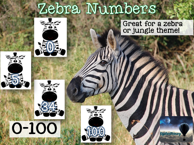
This animal-themed numbers display resource features zebras numbered from 0 to 100, ideal for EYFS and KS1 classrooms. Perfect for jungle or safari themed displays, maths areas, role play corners, or creating number lines and counting activities.
What’s Included:
✔ Printable PDF with numbers 0–100 on individual zebra images
✔ Option to select pages for counting in 2s, 5s, 10s, or full number lines
✔ Suitable for displays, role play areas, and maths activities
Lesson Overview / Structure:
★ Display and Visual Learning
Build a full number line from 0 to 100 across the classroom
Choose specific numbers to support counting patterns such as 2s, 5s, or 10s
Add to maths working walls, jungle-themed displays, or safari-themed role play corners
★ Active Classroom Use
Sequence numbers with pupils
Create interactive games such as missing number activities or counting challenges
Why It’s Useful:
✔ Supports number recognition and counting skills
✔ Flexible use for multiple counting patterns
✔ Fits well with jungle, safari, or animal-themed classroom topics
✔ Easy to adapt for different group activities
Suggested Use Cases:
Ideal for EYFS and KS1 classrooms, maths displays, number lines, jungle and animal themed role play areas, and counting activities across the curriculum.
Search Tags:
Numbers 0–100 | zebra numbers display | EYFS maths resource | KS1 number line | jungle theme classroom | animal themed maths | counting in 2s 5s 10s | back to school maths
Dive into the world of maps with this dynamic KS2 geography lesson on latitude and longitude, crafted for Years 3-6. This ready-to-teach resource delivers an engaging, curriculum-aligned experience that helps students master map skills and impresses in observations.
What You Get
Interactive PowerPoint with clear visuals to explain latitude, longitude, the Equator, and the Tropics
Hands-on worksheets, including map-labeling tasks and sentence-writing activities
Detailed lesson plan with step-by-step guidance, objectives, and differentiated tasks
Catchy video song to reinforce the difference between latitude and longitude
WAGOLL examples and sentence starters to support all learners
Full set of resources: starter task, world map activity, writing task, success criteria, word bank, and more
Learning Objectives
Distinguish between weather and climate
Label and explain the significance of latitude, longitude, the Equator, and the Tropics
Understand the direction and purpose of these lines
Describe country locations using latitude and longitude
Who It’s For
KS2 teachers (Years 3-6) teaching geography or map skills
NQTs or ECTs preparing for interview lessons or observations
Educators seeking Ofsted-ready, engaging geography resources
Why It Works
Proven in observations, meeting high teaching standards
Aligns with KS2 geography curriculum for locational knowledge
Keeps students engaged with varied tasks and a memorable song
Differentiates for all abilities, ensuring every learner succeeds
Saves prep time with all materials ready to use
Great For
Teaching latitude, longitude, and map skills in KS2
Delivering standout geography lessons for observations
Building confidence in navigating the world’s grid
Instant download. Fully editable. Ready to teach.
Tags
KS2 geography lesson, latitude and longitude, Years 3-6 map skills, weather and climate, Equator and Tropics, hemispheres, Earth’s grid, primary geography resources, Ofsted observation lesson, KS2 locational knowledge
This Africa Homework Pack offers a wide range of creative activities designed to extend pupils’ learning across KS2. Covering geography, history, science, maths, writing, and reading, this pack supports themed homework projects linked to Africa and encourages pupil choice and independence.
What’s Included:
✔ Africa Homework Choice Board with 30 cross-curricular tasks.
✔ PDF of 54 African flags for decorating activities.
✔ Africa factfile worksheet for research tasks.
Lesson Overview / Structure:
★ Choice Board Activities:
Pupils can select tasks from a grid of 30 different activities, choosing which and how many they complete each week.
★ Cross-Curricular Learning:
Tasks are linked to a range of subjects, including researching African animals, creating graphs using African mountain data, writing projects, and more.
★ Supporting Materials:
Includes a printable set of African flags and a factfile worksheet to support research and creative tasks.
Why It’s Useful:
✔ Encourages independent learning and pupil choice.
✔ Supports cross-curricular links to geography, maths, science, and literacy.
✔ Flexible for whole-class projects or differentiated homework.
✔ Provides ready-to-use homework options to save teacher planning time.
Suggested Use Cases:
Ideal for KS2 geography homework projects, cross-curricular topic work, enrichment tasks, remote learning, or extension activities linked to an Africa topic.
Search Tags:
KS2 Africa homework | Africa topic KS2 | KS2 geography homework | Cross-curricular homework KS2 | Year 3 4 5 6 homework pack | Outstanding Africa resources | KS2 home learning
This Beside the Seaside Homework Grid offers a wide range of activities designed to support cross-curricular learning across KS1. Covering geography, history, science, maths, writing, and reading, this pack provides a flexible and engaging way for pupils to extend their learning through a seaside theme.
What’s Included:
✔ Beside the Seaside Homework Grid with 44 cross-curricular tasks.
✔ Parent letter explaining the homework project.
✔ Record sheet for pupils to track completed tasks.
Lesson Overview / Structure:
★ Choice Board Activities:
Pupils select from 44 tasks covering a variety of subjects, choosing which activities to complete each week.
★ Cross-Curricular Learning:
Tasks encourage skills in writing stories, creating bar graphs, making scientific observations, and linking maths and geography to the seaside theme.
★ Supporting Materials:
A parent letter is included to explain the project, along with a pupil record sheet to support independent work.
Why It’s Useful:
✔ Encourages independent learning and pupil choice.
✔ Supports a cross-curricular approach across core and foundation subjects.
✔ Flexible for whole-class projects or differentiated homework.
✔ Helps to build home-school links with a clear explanation for parents.
Suggested Use Cases:
Ideal for KS1 seaside topic homework, summer term home learning, cross-curricular topic work, or extension tasks linked to geography, history, and science.
Search Tags:
KS1 seaside topic | Seaside homework activities KS1 | Year 1 homework pack | Year 2 homework grid | Cross-curricular seaside KS1 | Outstanding KS1 resources | KS1 summer topic
This Great Explorers Homework Grid provides a wide range of activities designed to support cross-curricular learning across KS1. Covering geography, history, science, maths, writing, and reading, this pack offers flexible options for pupils to extend their learning through the exciting theme of great explorers.
What’s Included:
✔ Great Explorers Homework Grid with 51 cross-curricular tasks.
✔ Parent letter explaining the homework project.
✔ Record sheet for pupils to track completed tasks.
Lesson Overview / Structure:
★ Choice Board Activities:
Pupils select from 51 tasks across a variety of subjects, choosing which activities to complete each week based on their interests.
★ Cross-Curricular Learning:
Tasks encourage skills such as writing creatively, drawing maps, researching famous explorers, applying basic maths through costing activities, and imagining new discoveries.
★ Supporting Materials:
A parent letter is provided to introduce the project, alongside a pupil record sheet to promote independent tracking and goal-setting.
Why It’s Useful:
✔ Encourages independent learning and pupil choice.
✔ Supports a cross-curricular approach across core and foundation subjects.
✔ Flexible for whole-class projects or differentiated homework.
✔ Helps to build home-school links with clear information for parents.
Suggested Use Cases:
Ideal for KS1 history homework, cross-curricular explorers topic, home learning projects, extension tasks linked to geography and science, or summer term activities.
Search Tags:
KS1 explorers topic | Great explorers homework KS1 | Year 1 homework pack | Year 2 explorers activities | Cross-curricular homework KS1 | Outstanding KS1 resources | Famous explorers project KS1
Create a calm and welcoming learning space with this rainforest-themed classroom display set, ideal for EYFS, KS1, and KS2. Designed to support a soothing environment, it is particularly helpful for pupils with sensory needs and SEND. Perfect for back-to-school classroom decoration or topic displays.
What’s Included:
✔ Bunting – blank and alphabet versions
✔ Days of the week posters
✔ Drawer labels (plus blank versions)
✔ Alphabet letter squares (plus blanks)
✔ Number squares up to 31 (plus blanks)
✔ Months of the year display
✔ Daily schedule display
✔ Table number signs
✔ Voice level meter poster
✔ ‘Welcome to…’ door signs (Nursery to Year 6)
✔ Binder covers
✔ Editable labels
Lesson Overview / Structure:
★ Setting up your classroom
Use bunting, door signs, and wall displays to create a rainforest-themed classroom environment.
Apply number squares, alphabet squares, and months of the year displays to support daily routines.
Display the voice level meter and schedule posters to promote classroom management and consistency.
★ Adapting for sensory needs
The calming colours and nature theme are designed to create a relaxed atmosphere, suitable for pupils who benefit from sensory-friendly spaces.
Why It’s Useful:
✔ Creates an engaging and calming classroom environment
✔ Supports daily routines with visual prompts
✔ Includes editable options for flexibility
✔ Suitable for EYFS, KS1, and KS2 classrooms
✔ Helps meet the needs of pupils with SEND
Suggested Use Cases:
Ideal for back-to-school classroom setup, rainforest-themed topics, EYFS classrooms, KS1 and KS2 displays, and sensory-friendly learning environments.
Search Tags:
rainforest classroom display | jungle theme classroom | EYFS classroom decor | KS1 display resources | KS2 rainforest display | back to school classroom setup | sensory friendly classroom | display labels bunting | rainforest topic classroom | Y1 Y2 Y3 Y4 Y5 Y6
This 16-slide PowerPoint assembly introduces students to the real-life school journeys of children from around the world, including those in Ecuador. Pupils will learn about how children like Jefferson and Lizbeth travel through the rainforest or by canoe on the River Napo to reach school. This resource provides a global perspective on the importance of education, despite the challenges these children face.
What’s Included:
✔ 16-slide PowerPoint presentation
✔ Real-life stories of children’s school journeys
✔ Images and descriptions of the children’s experiences in Ecuador
✔ Insights into the geography and culture of different countries
Lesson Overview / Structure:
★ Introduction: Students are introduced to the concept of school journeys around the world, with a focus on children in Ecuador.
★ Main Activity: The PowerPoint explores the unique paths to school, showing how children in different environments navigate to school.
★ Reflection: Students reflect on their own school journeys and the importance of education.
Why It’s Useful:
✔ Encourages global awareness and cultural understanding
✔ Provides a meaningful discussion starter for KS1 and KS2 students
✔ Can be used for whole-school assemblies or classroom activities
✔ Helps students reflect on their own experiences and challenges
Suggested Use Cases:
This assembly is ideal for KS1 and KS2 geography lessons, global awareness topics, or as part of a school-wide assembly. It’s also perfect for promoting discussions on education and cultural differences.
Search Tags:
KS1 geography | KS2 geography | school journeys | global education | Ecuador | cultural awareness | outstanding global assembly
This fully resourced KS2 geography lesson teaches pupils how to interpret and present weather data using tables, bar charts, and choropleth maps. Designed for Year 3 or Year 4, the lesson focuses on identifying how weather varies across the UK and using weather data to spot patterns.
What’s Included:
✔ PowerPoint presentation
✔ Weather data table (example UK locations)
✔ Blank bar chart templates
✔ Sentence stems for support
✔ Differentiated comparison task
✔ Printable resources for graphing
✔ Plenary discussion prompts
Lesson Overview / Structure:
★ Starter: Pupils analyse weather photos from across the UK and discuss visible differences in conditions. A class list of descriptive weather terms is created.
★ Main Input: Teach pupils how weather is measured and how data is collected (rainfall and temperature). Use a weather data table and demonstrate how to transfer this into a bar chart. Introduce a UK choropleth map and teach pupils how to read the key and identify patterns.
★ Activity: Pupils create their own bar charts using local or example weather data. They write three comparative sentences based on what they notice.
★ Differentiation:
– Support: Pre-labelled bar chart template and sentence stems.
– Challenge: Pupils calculate averages and describe trends in the data.
★ Plenary: Use speech bubble prompts to discuss how data can reflect lived experiences of weather. Children explain their reasoning using evidence from their charts or maps.
Why It’s Useful:
✔ Builds geographical skills using real-world data
✔ Supports cross-curricular links with maths (data handling)
✔ Encourages critical thinking and reasoning
✔ Differentiated for a range of abilities
Ideal for Year 3 or Year 4 geography lessons focusing on weather, data interpretation, or UK climate zones. Can also be used for science or cross-curricular topics involving graphing skills.
Search Tags:
KS2 geography | UK weather lesson | weather data bar chart | Year 4 climate activity | interpreting data KS2 | weather comparison UK | outstanding data handling | map skills KS2 | climate variation UK | primary geography resources
This KS2 geography lesson introduces pupils to the temperate climate zone, focusing on the UK’s climate and its impact on people, plants, and animals. It also includes an introduction to biomes and a gentle discussion about climate change and its effects.
What’s Included:
✔ PowerPoint presentation for direct teaching
✔ Temperate biome fact sheet
✔ Poster template for pupil work
✔ Word bank and picture prompts for support
✔ Link to child-friendly climate change video
Lesson Overview / Structure:
★ Starter: Children locate the UK on a world map and describe its position relative to the Equator and poles. They write three adjectives to describe the UK’s weather.
★ Main Activity: Introduce temperate climate zones and explain how they differ from tropical and polar regions. Use images to show the UK’s biome (deciduous forest) and discuss seasonal changes, weather, plants, and animals. Children complete a poster showing features of the UK’s climate, flora, fauna, and human activity.
★ Differentiation:
– Support: Word bank and images
– Challenge: Include examples of how extreme weather can impact life in the UK
★ Plenary: Watch a short video introducing the idea of climate change. Discuss how future weather changes might affect people and nature. Children reflect on the key facts learned.
Why It’s Useful:
✔ Aligned with UK geography curriculum (KS2 climate zones and biomes)
✔ Encourages awareness of climate and seasonal changes
✔ Differentiated for a range of learners
✔ Supports geography, science, and PSHE links
Ideal for Year 3–4 geography lessons focused on climate, UK weather, biomes, or sustainability topics. Can also support work on seasons, ecosystems, or environmental change.
Search Tags:
KS2 climate zones | UK weather lesson | temperate biome Year 4 | deciduous forest KS2 | geography UK seasons | outstanding geography resource | climate change Year 3 | UK biome worksheet | British trees lesson KS2 | climate teaching pack KS2
This lesson introduces KS2 students to the unique characteristics of temperate and Mediterranean climate zones. Pupils explore key concepts such as weather patterns, climate influences, and biome distinctions while developing essential map-reading and comparison skills.
What’s Included:
✔ Editable PowerPoint presentation
✔ Printable fact file sheets
✔ Comparison table worksheet
✔ Postcard template for extension activity
✔ Lower ability postcard support sheet
✔ x2 Postcard WAGOLLs
✔ Lesson plan
Lesson Overview / Structure:
★ Starter: Engage students with a quick activity to spark discussion about different climate zones.
★ Main Activity: Use visual aids and a digital map to examine the features of temperate and Mediterranean climates, supported by fact sheets.
★ Independent/Group Activity: Students complete a comparison table and work on a creative extension task using the postcard template.
★ Plenary: Wrap up with a brief review and discussion to reinforce key vocabulary and concepts.
Why It’s Useful:
✔ Enhances understanding of global climate differences
✔ Develops map skills and data comparison techniques
✔ Provides differentiated support for mixed-ability groups
✔ Aligns with national KS2 geography curriculum outcomes
Ideal for KS2 geography lessons, cross-curricular projects linking to science and social studies, and group discussion activities. Suitable for whole-class instruction or small group work.
Search Tags:
KS2 geography | temperate climate lesson | Mediterranean climate comparison | Year 4 geography | outstanding geography resource
This KS2 geography lesson introduces pupils to the climate, location and features of tropical rainforest regions around the world. Pupils learn how climate zones and biomes are connected and use maps and group activities to research key regions such as the Amazon and Southeast Asia.
What’s Included:
✔ Editable teaching PowerPoint
✔ Blank world map for labelling climates and rainforests
✔ Printable rainforest fact file template (for lower-ability pupils)
✔ Detailed lesson plan
★ Lesson Overview / Structure:
★ Starter: Use a coloured world rainfall map to prompt discussion about the wettest places on Earth and introduce the concept of tropical rainforests.
★ Main: Pupils learn about monsoon rain using examples from India. Introduce the term ‘tropical rainforest biome’ and explore crops, animals and homes found in these regions.
★ Independent Task: Pupils locate and label four rainforest regions and create a page describing the climate, rainfall and biome features. Pages are combined to form a group rainforest book.
★ Plenary: Reflect on life in a rainforest environment through guided imagination and class discussion.
Why It’s Useful:
✔ Builds understanding of climate zones, biomes and geography vocabulary
✔ Includes group research and mapping task
✔ Differentiated support materials included
KS2 geography topic work | Year 3–4 climate zones and biomes | World map skills | Cross-curricular work with science or PSHE
Search Tags:
KS2 geography | climate zones lesson | tropical rainforest biome | Year 3 rainforest | monsoon lesson plan | world rainfall map KS2 | outstanding geography resource | KS2 biomes and climate zones | rainforest research project KS2
This KS2 geography resource helps pupils compare the climate and living conditions of polar, subpolar and arid regions. Suitable for Years 3–4, the lesson introduces key differences in temperature, rainfall and habitability, with a focus on map skills and geographical vocabulary.
What’s Included:
✔ Editable PowerPoint
✔ x3 Climate zone comparison worksheets (differentiated)
✔ Information cards for polar, subpolar and arid zones
✔ Matching activity sheet with environment images
★ Lesson Overview / Structure:
★ Starter: Children observe mystery climate photos and make predictions
★ Input: Teacher-led introduction to the polar, subpolar and arid climate zones using map visuals
★ Main Task: Pupils complete a guided comparison table using climate data and key facts
★ Extension: Matching activity linking environments to their climate zone
★ Plenary: Partner discussion and vocabulary recall
Why It’s Useful:
✔ Clear links to the national curriculum for geography
✔ Supports map skills and use of geographical vocabulary
✔ Differentiated worksheets and extension task included
✔ Encourages critical thinking and group discussion
KS2 geography | Climate zones topic | Comparing extreme environments | Whole-class map skills lesson | Cross-curricular geography and science
Search Tags:
KS2 geography | climate zones KS2 | comparing polar and arid climates | Year 4 geography lesson | polar vs desert climate KS2 | outstanding geography resource | climate comparison activity KS2 | Year 3 climate lesson | subpolar zone worksheet
This KS2 geography lesson introduces pupils to tropical desert climate zones and biomes. Ideal for Years 3–4, the resource helps children understand key features of hot, dry environments and the impact of climate on landscapes, wildlife, and human life. The activity also supports world map skills and topic vocabulary.
What’s Included:
✔ Editable PowerPoint presentation
✔ Blank world map worksheet
✔ Tropical desert information sheets
✔ Differentiated support sheet
✔ Exemplar answers for each ability
★ Lesson Overview / Structure:
★ Starter: Introduces the concept of hot and dry places using a temperature map
★ Main Input: Pupils locate key deserts and learn about climate and biome features
★ Activity: Children label deserts on a world map and describe the desert biome using support materials
★ Extension: Comparison of two desert regions and how humans adapt
★ Plenary: Class quiz and vocabulary recap
Why It’s Useful:
✔ Supports understanding of climate, biomes, and world geography
✔ Builds map skills and geographical vocabulary
✔ Includes differentiation for a range of abilities
✔ Flexible for independent or group learning
KS2 geography | World climate zones | Desert biome studies | Year 4 map skills | Comparing global environments | Geography and science cross-curricular links
Search Tags:
KS2 geography | tropical deserts KS2 | desert biome lesson | Year 4 geography climate | hot and dry zones KS2 | outstanding desert lesson | arid zones map | Year 3 world biomes | desert animals KS2
This lower KS2 geography lesson introduces children to the climate and features of the polar regions and tundra biome. Designed for Years 4–6, the resource helps pupils understand key differences between the Arctic and Antarctic, develop map skills, and consider how animals survive in extreme conditions.
What’s Included:
✔ Editable PowerPoint presentation
✔ x3 Differentiated Polar regions comparison worksheets and answers
✔ Printable fact cards for Arctic and Antarctic
✔ Tundra biome fact sheet
Lesson Overview / Structure:
★ Starter: Children identify the coldest parts of the world using a map and temperature zones
★ Main Input: Introduces key facts about the Arctic, Antarctic, and tundra biome using visuals and discussion prompts
★ Paired Task: Pupils complete a polar comparison chart using fact-based clues
★ Follow-Up Activity: Children select and label an animal adapted to cold climates
★ Plenary: Class quiz recap to reinforce main differences between polar regions
Why It’s Useful:
✔ Encourages map reading and geographical vocabulary
✔ Supports understanding of climate zones and biomes
✔ Includes differentiated tasks for varied ability levels
✔ Ready to use with minimal preparation
KS2 geography | Climate zones and biomes topic | Whole-class or group lesson | Lesson observations or display work | Science and geography link
Search Tags:
KS2 geography | polar regions lesson | tundra biome KS2 | Year 4 geography | Arctic and Antarctic comparison | outstanding climate lesson | Year 5 map skills | Year 6 geography topic | cold climates KS2
A fully resourced geography lesson for Lower Key Stage 2 focusing on observing, measuring and describing local weather. Designed to support understanding of weather vocabulary, instruments, and differences across locations in the UK. Ideal for developing enquiry skills through practical data collection.
What’s Included:
✔ Detailed lesson plan
✔ Teaching PowerPoint
✔ Weather recording sheet
✔ Rain gauge instructions
✔ List of required materials
Lesson Overview / Structure:
★ Introduces key terms and weather symbols
★ Practical group task to observe and record weather data
★ Differentiated activities to support discussion and analysis
★ Opportunities to develop vocabulary and reasoning
★ Includes group reflection and simple assessment task
Why It’s Useful:
✔ Clear, structured approach to teaching weather concepts
✔ Supports outdoor learning and real-life data collection
✔ Differentiated to suit a range of learners
✔ Cross-curricular links to science and maths
✔ Minimal prep required for class teachers
Suitable for KS2 geography lessons | Weather and climate topics | Local area fieldwork | Outdoor learning sessions | Whole-class or group enquiry
Search Tags:
KS2 geography | weather observation KS2 | Year 3 geography lesson | Year 4 weather investigation | measuring rainfall activity | rain gauge KS2 | LKS2 geography planning | outdoor geography KS2 | outstanding KS2 weather lesson | climate vs weather KS2
A clear, engaging KS2 geography lesson introducing weather, climate and biomes. Suitable for Year 3 or Year 4, this resource uses maps and visual prompts to help pupils build key vocabulary and understand climate variation around the world.
What’s Included:
✔ Detailed lesson plan
✔ Teaching PowerPoint (fully editable)
✔ Printable world map worksheet (blank climate zones)
✔ Biome picture cards for sorting or discussion
★ Lesson Overview:
★ Starter: Pupils begin by discussing weather in their local area and comparing seasons.
★ Main Input: Key terms such as weather, climate and biome are explained with visual prompts.
★ Activity: Children use the blank world map and biome cards to identify and link different climates and natural environments.
★ Plenary: A short reflective task encourages pupils to summarise their learning using new vocabulary.
Why It’s Useful:
✔ Focuses on vocabulary and visual learning
✔ Supports geographical knowledge and map skills
✔ Easy to adapt for different abilities or lesson lengths
✔ Ideal for introducing biomes and climate zones in a simple way
Suggested Use Cases:
KS2 geography | Year 3 climate lesson | Year 4 weather and biomes | whole class teaching | map work | geography starter lesson | curriculum-linked vocabulary work
Search Tags:
KS2 geography | weather climate biomes | Year 3 lesson | Year 4 geography | climate zones worksheet | world map activity | outstanding primary geography | lower KS2