Water Cycle worksheets that are aimed at higher and lower ability pupils at KS3.
These worksheets take the pupils through terms such as evaporation, transpiration, throughflow, infiltration, surface run off, condensation.
They could equally be used in KS2 or KS4 Geography and Science depending upon the ability level of your pupils.
This worksheet uses the Hans Rosling Youtube documentary called “Don’t Panic” to discover the impacts of global population growth. The questions start with largely factual responses to the documentary, but build towards developing structured answers about population growth.
Use this resource to help pupils discover locations of UK mountain ranges. It is differentiated in to two levels for higher and lower ability pupils.
The resource comes with the lesson outlined on powerpoint, with word worksheet files all ready to print out and use with your class.
It was initally designed for a Year 7 class but could equally be used right down to KS1.
There are two main exercises in this lesson.
Activity 1. - A collaborative group exercise where the pupils organise a UK map of mountain ranges and decide between the group, the appropriate labels and heights. This is a great exercise to visualise the mountains, and not merely view them on a map without any understanding of the vegetation or relief of the land.
Activity 2. This activity consists of differentiated worksheets with and extension task and some higher order thinking questions that provide enough extension for pupils.
The whole lesson comes with a Powerpoint to guide you and the class through the lesson.
This resource is a case study of the 2011 Japanese Earthquake and Tsunami that struck the area of Sendai and Japan. The magnitude 9 earthquake could be felt over a large area, and triggered a 40ft Tsunami wave.
Due to Japan being a HIC/MEDC/ Developed country the country was well prepared for the event and amazingly only 15000 people died. However the quake caused many other significant economic and environmental problems.
This resource uses a BBC News article from the day that is linked from the worksheet. Pupils respond to the video and answer various factual questions and are asked to summarise the events of the day with a tweet. This is a good resource for a cover lesson, home learning, or introduction to the event.
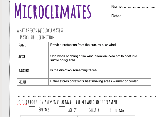
This resources introduces air masses to the weather module. It uses a clip from the Met Office that explains the different air masses, and pupils have to annotate the diagram, match up the definitions and decide which air mass produces different types of weather.
It can be set as a standalone homework task or a cover lesson.
A 35 -60 minute lesson plan aimed at Key Stage 3 but could also be used at Key Stage 4. Included files are a lesson plan and powerpoint file with all necessary questions and linked videos.
This lesson is an ethical debate based upon the ideas of Plato’s cave.
This resource uses a number of Youtube videos and Powerpoint presentations to present the students with a series of information about the Himlayas. Pupils then have to locate the Himalayas and identify the countries in which they are found.
There are further questions based on the climate, before going into a more detailed exploration of Everest and Base Camp.
Finally pupils are to write a post card imagining that they are writing from base camp describing the mountain region and its climate.
A worksheet resource that helps pupils understand how Headlands and Bays are formed in coastal processes. Pupils are asked to sketch out the effect of waves on hard and soft rock, before completing a true or false task on headland and bay formation.
These worksheets take your pupils through the organisation of a fieldwork trip suitable for studying how rivers change from upstream to downstream.
This resource is based on the River Caldew in Cumbria, but the maps can be easily adapted to a location near you.
The worksheets take the pupils through identifying a hypothesis, locations, and completing a risk assessment for the trip.
The data that can be recorded on the sheets are cross sectional area, width, and velocity of river at three different sites.
This is a ready made resource that will enable you to complete a fieldwork day in your local area.
A River Meander Worksheet that helps pupils understand how river meanders are formed. The key terms covered include Erosion, Deposition, Slowest River Flow, Fastest River Flow, River Cliff, Slip Off Slope, and Thalweg.
The worksheet starts with a labelling activity on a cross section of a river and a overhead view of a meander. This is followed by a true or false activity where pupils have to consider whether the river would cause a number of different scenarios.
Pupils are then asked to consider what would cause the river to increase in sinuosity and jot these ideas down as a mind map.
Lastly the higher order thinking question asks pupils to think about the implications of rivers on cities such as London or Nottingham.
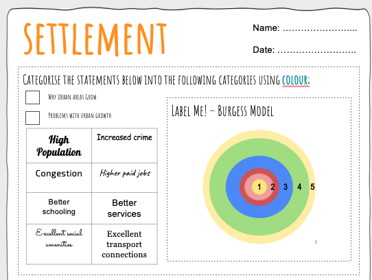
These worksheets are designed as a review of learning during the KS3 and Common Entrance Geography Settlement module.
There are a number of activities for the students to do. THe lower ability sheet asks the pupils to use colour to identify reasons why settlements grow, and then problems that can be caused. The next section asks the students to label the Burgess model.
Following this there is a true and false section where pupils identify statements that are true or false about the redevelopment of the Olympic park in London.
The pupils are then asked to label the Settlement Hierarchy, and as an extension identify typical services at each level.
The final task on the lower ability sheet is to identify the odd one out words related to settlement hierarchy, and urban growth.
The higher level worksheet follows a similar pattern, but asks the pupils to explain why urban areas grow using the key words used in the lower ability task.
The pupils are also asked to explain whether the redevelopment of the olympic park was a success or not.
The resource is fully customisable and you can adapt for your own needs. You will probably need to adapt the case study section.
This worksheet follows a documentary produced on Youtube. The students answer questions based on information presented in the video. These questions build their case study knowledge of HS2 before they attempt to answer a 6 mark question.
This is an assembly aimed at inspiring students to achieve their goals and not set limits. It looks at the first moon landing, the breaking of the 4 minute mile, and the breaking of the 2 hour marathon. It allows the presenter to promote a Growth Mindset.
There are video clips that play automatically when used with Google Slides. If used with Powerpoint you will have to set up the automation.
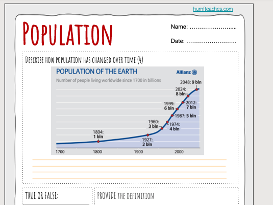
A Geography worksheet asking pupils to identify reasons for global population growth. Pupils have to analyse the trends in the graph alongside some true or false questions that stimulate debate in a class review.
This is a differentiated resource for KS3 or KS4 that enables pupils to use a sophisticated digital mapping website to predict the weather for the following day.
They are asked to produce a forecast using video or podcast, but first need to formulate their script using n excellent weather website that visualizes current temperature, wind speed, air pressure and many other weather variables.
The standard worksheet structures the questions pupils should follow in developing their script. The more advanced version allows for pupils to structure their own script and weather variables they think are important to present.
THis resource is an introduction to the structure of the earth. It uses a Youtube Video and asks questions based on the material presented.
Pupils then have a Larger or Smaller task, and a labelling of the earths structure.
This worksheet recaps the ideas behind a basic industry module.
It asks pupils to identify occupations and categorise them into Primary, Secondary, Tertiary and Quarternary activities.
It then asks the pupils to identify each economic sector on the demographic transition model.
The third element is a true or false case study task about Nike and its development of factors across the glob. This could be easily adapted for Apple or other TNC. The questions should promote an amount of discussion because they are not actually “true or false” and can be debated.
The final section is an odd one out task, that I have tried to make difficult based on previous pupils questions and experiences.
This is an exercise identifying coastal features from a map. In my classes I have exchanged the opensource map for an Ordnance Survey map, so if you have access to OS mapping you may want to exchange the maps.
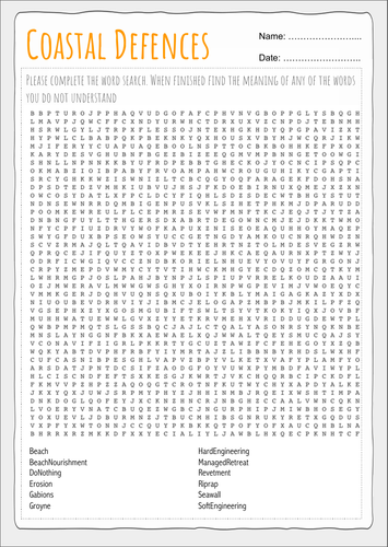
A word search containing key words for Coastal Management. It would be useful as a lesson starter or filler encouraging pupils to learn key words and spellings.