Hi, I'm Shima! I'm a language teacher who believes in creating inclusive and engaging learning environments for all students. With over 12 years of experience and a Master's in TEFL, I've developed a unique approach to teaching that blends traditional methods with innovative techniques. Awarded 1st place in the National Story Writing Competition in French. In my store, you'll discover a wide range of resources designed to inspire your students, foster critical thinking, and make learning fun! I
Hi, I'm Shima! I'm a language teacher who believes in creating inclusive and engaging learning environments for all students. With over 12 years of experience and a Master's in TEFL, I've developed a unique approach to teaching that blends traditional methods with innovative techniques. Awarded 1st place in the National Story Writing Competition in French. In my store, you'll discover a wide range of resources designed to inspire your students, foster critical thinking, and make learning fun! I
Embark on an exciting journey to Yellowstone National Park with this engaging geography and science resource designed for students in grades 3-6! This comprehensive packet combines informational text with a variety of fun activities to help students discover the unique features, fascinating wildlife, and amazing geothermal wonders of America’s first national park.
This packet includes:
Where is Yellowstone? Map Activity: Students locate and label the states where the park is located.
Geysers and Hot Springs Reading Passage & Questions: Learn about Old Faithful, Grand Prismatic Spring, and the science behind geothermal activity.
Wildlife Wonders Matching: Match descriptions to key Yellowstone animals like bison, wolves, grizzly bears, and elk.
Yellowstone Fast Facts (True or False): Assess comprehension of key facts about the park’s history, features, and wildlife.
Yellowstone Word Search: Reinforce key vocabulary terms related to the park.
“Writing Time” Prompt: Encourage creative writing by imagining a visit to Yellowstone.
Detailed Answer Key: Makes grading quick and easy for teachers.
This versatile resource is perfect for Social Studies lessons on U.S. Geography and National Parks, Science units on geology and ecosystems, or integrating informational text into your ELA curriculum. It’s ready to print and use for independent work, learning centers, homework, or whole-class activities!
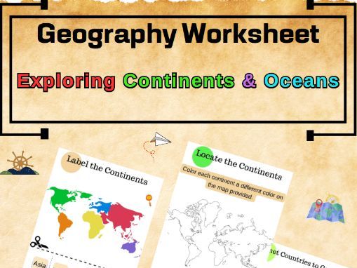
Embark on a cartographic adventure with “Global Explorer,” an interactive geography worksheet designed to navigate the wonders of our world. This comprehensive PDF is the perfect tool for students to master the names of continents, countries, and oceans, and engage in an array of activities that bring the map to life.
Dynamic Learning Activities:
Label the continents and add a splash of color to each one.
Identify and match countries to their respective continents.
Explore the vast oceans by numbering them correctly.
Creative and Educational:
Encourages hands-on learning through coloring and labeling.
Reinforces memory retention of geographical facts.
Suitable for various educational levels, from elementary to middle school.
Teacher-Friendly Resource:
Easy-to-print PDF format, ready for classroom use.
Clear instructions for students to follow independently or in groups.
Versatile use for in-class activities, homework, or homeschooling.
Enriching Classroom Experience:
Enhances geographical literacy and map-reading skills.
Fosters an understanding of global diversity and geography.
Perfect for social studies, world history, or general knowledge enhancement.
Engage and Educate:
Watch as your students become global explorers, navigating from the Sahara to the Siberian plains.
Empower your students with the knowledge to connect countries, continents, and oceans.
Dive into “Global Explorer” and provide an enriching educational experience that paints the world in a spectrum of learning. Add this worksheet to your curriculum and chart a course for geographic mastery on Teachers Pay Teachers!
Bring South America to life for students with these useful and engaging geography printables! This packet includes:
Illustrated maps of South America for labeling country names
Country fact sheets listing each capital city, primary languages, and space to share cultural facts
Fun dice game to prompt students to share a unique fact about each South American country
Students will love the hands-on activities that boost retention, like tracing country names on maps and rolling dice to tell a fact. The capital city and language charts allow for differentiated activities - have students research and fill in any unknown details or provide them with the info to reinforce.
These printables creatively combine maps, facts, writing practice, and active learning games to engage various learning styles. They are perfect for country reports, social studies reviews, ELL support, and more!
Includes visual aids, writing practice, dice game
Targets map skills, country facts, discussion
Ideal for country reports or social studies
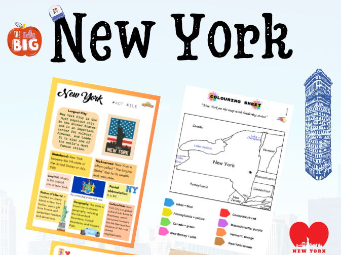
Bring the Empire State to life in your elementary classroom with these useful New York geography printables!
This interactive 5+ page packet includes:
Illustrated New York state map for coloring state borders and locating key features
Fact file on New York’s history, economy, landmarks and more
Engaging quiz activity with included answer key to test student knowledge
Young learners will love the hands-on activities that reinforce key geography concepts and regions of New York. These printables creatively combine maps, facts, multiple-choice questions, and coloring visuals to engage various learning styles.
Use them to enrich lessons on New York or northeast US geography! The activities are perfect for independent practice, centers, group work, or homework. Download this hands-on 5+ page resource now to reinforce geography skills!
Targets upper elementary grades
Fosters reading comprehension and critical thinking
Includes visual aids and instant feedback assessment
Are you looking for an engaging way to teach your 3rd and 4th-grade students about cardinal directions? This interactive Geography Compass Worksheet is the perfect resource! With clear instructions and visuals, your students will learn to identify and apply the concepts of north, south, east, and west through hands-on activities.
This worksheet is designed to reinforce directional skills while keeping your students entertained. The map-based exercises challenge them to locate places and navigate using cardinal directions, fostering spatial awareness and problem-solving abilities!
Key Features:
Printable and easy-to-use format
Engaging visuals and clear instructions
Aligns with Common Core State Standards and Next Generation Science Standards
Suitable for classroom use or homeschool learning
Explore California’s rich geography, history, and cultural symbols with this detailed classroom poster, designed for high school social studies! This PDF poster highlights essential facts about California’s geography, climate, key cities, mountain ranges, the California poppy, and the symbolic California state flag. Ideal for grades 9-12, this resource is perfect for enhancing students’ understanding of California’s unique natural and cultural heritage.
Display it in your classroom to spark curiosity, aid geography lessons, and give students a comprehensive overview of the Golden State!
Key Features:
Comprehensive Coverage: Details California’s geography, iconic cities, mountain ranges, state flower, and flag symbolism.
High-Quality Design: Visually engaging and informative, perfect for classroom display.
Educational Focus: Aids students in understanding California’s diverse geographical features and historical symbols.
Easy to Print: Provided in PDF format for quick download and printing.
Classroom-Friendly Resource: Great as a visual aid for social studies and geography lessons.
Explore the diverse and fascinating geography of Texas with this comprehensive resource designed for grades 4-8!
This product includes engaging fact files covering Texas state symbols, landforms, soil types, major cities, bodies of water, and more. Supplement your Texas history or geography curriculum with this engaging resource.
Key Features:
Complete Texas Overview: Covers essential geographical facts about the state.
Engaging Fact Files: Provides concise, informative summaries of key topics.
Multiple Worksheets: Reinforces learning with varied activities, including:
Multiple choice quiz
Matching activity
Mind Map activity
State Symbol Emphasis: Teaches about the state flower, bird, tree, and motto.
Landform Exploration: Focuses on Texas’s diverse landforms: plains, mountains, hills, andplateaus.
Soil Types Breakdown: Explains the different soil types found across the state.
Answer Key Included: Makes grading quick and easy.
Grades 4-8 Appropriateness: Designed for upper elementary and middle school students.
Printable & Easy to Use: Download the PDF and print the pages you need.
Unique Design: All the elements are created by the designer and there are no similar items online.