Welcome to my shop! I have lesson resources here for all age groups in secondary education. All my resources are all in one ppt lessons. That means they all have starters, different learning activities, reading resources (if required) and plenaries. Most of the lessons also have model answers for learning tasks which can aid your marking or promote self-assessment. The lessons are reviewed regularly so they are continually being improved. Just download and teach!
Welcome to my shop! I have lesson resources here for all age groups in secondary education. All my resources are all in one ppt lessons. That means they all have starters, different learning activities, reading resources (if required) and plenaries. Most of the lessons also have model answers for learning tasks which can aid your marking or promote self-assessment. The lessons are reviewed regularly so they are continually being improved. Just download and teach!
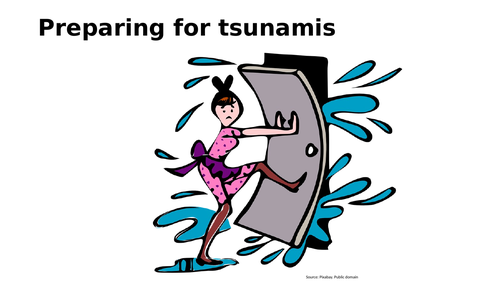
This is a KS3 level lesson on preparing for a tsunami response. It also explores how people responded to the Boxing day 2004 tsunami in the Indian ocean. Key facts about the lesson are:
The content covered by the lesson are; Definition of a tsunami, comparing tsunami wave with a normal sea wave, identifying practical steps to take in a tsunami, examination of the response to the Boxing day tsunami in 2004, classifying the responses to the 2004 tsunami as short and long term.
Learning resources used in the lesson are; Quiz, images, video clip, odd one out type task, written task using PEE technique with model answer as example, matching and analysis task. Answers are included for most of the tasks.
What do you get in the package: The lesson is planned in detail and all of the resources for teaching the lesson are included in the ppt; starter, learning activities with resources, clear outline of learning tasks and a plenary. However, students should always be encouraged to use their text book to broaden their understanding. Now just download and teach!
This is a lesson on the description and formation of salt pans, sand dunes and oasis in a hot desert. It is prepared for year 9 but can easily be used for a GCSE lesson. The reading resources and video clips needed are all included on the ppt. Activities include sequencing the formation of each landform and creating diagrams to show these.
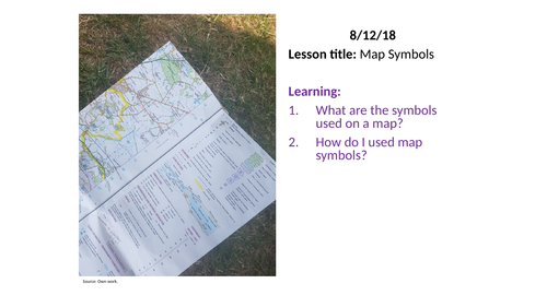
This is a KS3 / KS2 lesson on OS map symbols. It is an excellent lesson to peak students’ interest in maps and to pass on valuable map skills. Key facts about the lesson are:
The content covered by the lesson are; Definition of the term map symbol, identification of symbols for human and physical geographic features on a map, using symbols to collect facts about an an area on a map.
Learning resources used in the lesson are; map quiz, sketching task, map symbol story task and a short writing task.
The lesson is planned in detail and most of the resources for teaching the lesson are included in the ppt; starter, learning activities with resources, clear outline of learning tasks and a plenary. You will need copies of the OS map symbol key which can be found in textbooks or on OS maps. Now just download and teach!
This is a GSCE lesson on urban economies. Key facts about the lesson are:
1. The lesson explores the differences between the job sector and economic sector in cities in developed, developing and emerging countries.
2. The lesson compares primary, secondary, tertiary and quaternary sectors in different cities around the world
3. The lesson examines the differences between informal and formal employment. It also compares this in different countries.
4. The lesson looks at the Clarke-Fisher model.
5. The lesson is based on the new GCSE specifications.
6. It's a complete lesson with all the resources you need to deliver it - a starter, learning activities and plenary. All you will need is the ppt which I've attached. Just teach!
7. The lesson has a range of activities relevant to the assessment objectives of the new specifications. There is a active learning task where students have to move around the room, a written task for students to develop their question-answering skills and a couple of diagrams used to explain concepts.
8. The lesson has a couple of differentiated activities for students at either end of ability level.
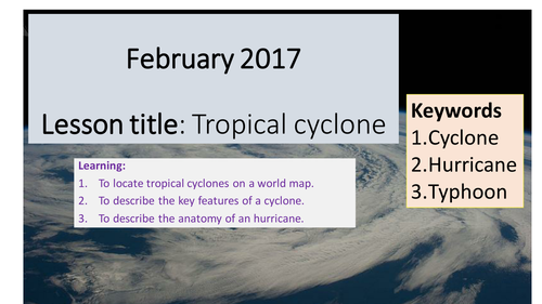
This is a GCSE lesson on tropical cyclones. Key facts about the lesson are:
1. The lesson explores the definition, location and structure of a tropical cyclone. This is a foundation lesson for studying a case study on the effects of tropical cyclones.
2. The lesson is based on the new GCSE specifications. However, it’s adaptable for an A-level group.
3. It's a complete lesson with all the resources you need to deliver it - a starter, learning activities and plenary. All you will need is the ppt which I've attached. Just teach!
4. The lesson has a range of activities relevant to the assessment objectives of the new specifications. There are numerous video clips to bring to life tropical cyclones, a couple of map tasks and a diagram annotation task examining the structure of a tropical cyclone.
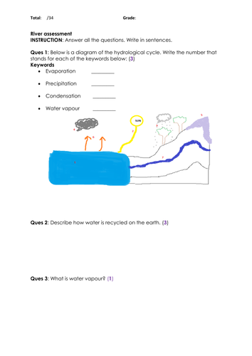
This is a assessment for a rivers unit at KS3. The test assesses students understanding of the features in the upper, middle and lower courses of the river. It also assesses students understanding of landforms created by the river as well as flood defences used by some rivers. There are 11 questions on the paper and the paper is modeled off the GCSE geography exam papers. The paper uses command words familiar with a GCSE paper. There is also a range of questions in terms of difficulty and skills needed similar to a GCSE paper.
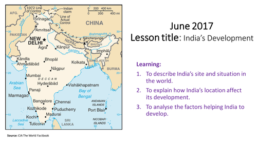
This is a GCSE lesson on the factors driving India’s development. Key facts about the lesson are:
1. The lesson explores the site and situation of India and how this has influenced its development as a emerging country.
2. The lesson also examines the other factors (political, historic, economic etc) influencing India’s development over the past 30 years.
3. The lesson is the first in a series of case study lessons on India’s development as an emerging economy. This is a requirement of the new GCESE specifications.
4. The lesson is designed to focus students thinking and discussion skills rather than them reading long texts to extract facts.
5. The lesson is differentiated through group work, a card sorting activity and a quiz.
6. It's a complete lesson with all the resources you need to deliver it – the learning activities from starter to plenary. All you will need is the ppt which I've attached. Just teach!
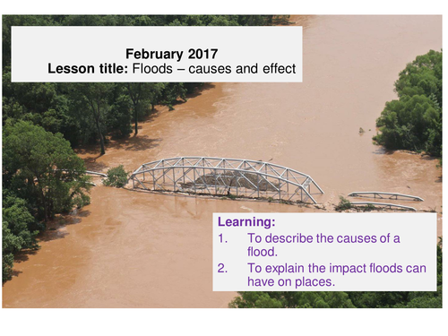
This is a two-part lesson on floods. The first lesson focuses on the causes of floods and their effects and the second lesson looks at flood management. The lesson is suited for both KS3 (year 9 group) and GCSE. Key facts about the lesson are:
1. All the resources for teaching the lesson are included. The ppts have everything from starter to plenary including all the geography resources for active learning.
2. The lesson is differentiated with a range of learning activities i.e. there are video clips, map work, card sort tasks, photo analysis and written tasks.
3. The lesson will challenge students at varying ability level and will generate discussion and debate which will engage students in their learning.
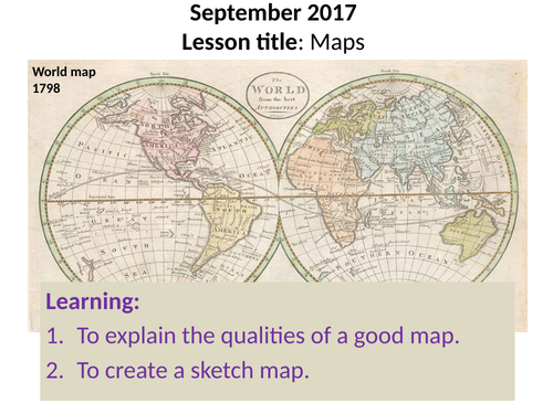
This is a lesson introduces students to the main ingredients of a good map. Students will then get a chance to apply their learning by creating a sketch map using these qualities. Key facts about the lesson are:
1. All the resources for teaching the lesson are included. The ppt has everything from starter to plenary including all the teaching resources for the lesson. Download and just teach!
2. The lesson is differentiated with support for learners of varying abilities.
3. The lesson is a map based lesson however, there are opportunities for discussions and reflection on the use of maps.
4. The lesson is a very practical - students will be engage in a kinaesthetic activity throughout.
There are three (3) lessons on coasts included in this bundle.
One lesson is an introduction lesson on coasts focusing on the features by the coast and the importance of learning about it in schools.
The other lesson is on wave and tide formation including a look at the features of a wave.
The final lesson is on constructive and destructive waves (including swash and backwash); how they compare and how the affect the coasts differently.
All three lessons have all the elements and the resources required to deliver them - starter, learning activities with resources and plenary.
There are three lessons in this bundle on floods.
1. One lesson covers the nature and causes and effects of floods.
2. The other lesson covers the flood defences focusing on hard and soft engineering solutions and a case study on the Thames Barrier. This is a differentiated lesson for lower ability group.
3. The final lesson is also on flood management however, this lesson is differentiated for a higher ability group or a GCSE group. The key ideas of the 3ps are included in this lesson as well.
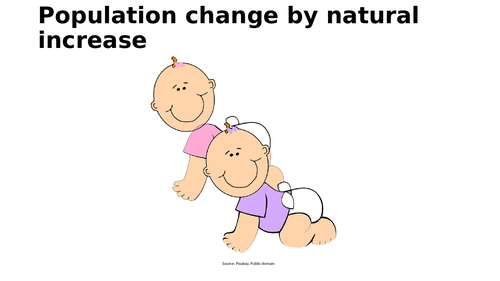
This is an 2 part A-level lesson on population change by natural increase. It is suitable for all specification but specifically the AQA A-level and Cambridge International specs. Key facts about the lesson are:
The content covered by the lesson are; Population change since 1800. Definitions of key vital statistics. BRs, DRs, IMRs, FR and NI rates across the world. Demographic reasons for population change. Other reasons for population change. Analysis of the reasons for population change in different periods.
Learning resources used in the lesson are; Quiz, images, video clip, map task, written task, analysis tasks, and exam focus questions.
What do you get in the package: The lesson is planned in detail and all of the resources for teaching the lesson are included in the ppt; starter, learning activities with resources, clear outline of learning tasks and a plenary. However, students should always be encouraged to use their text book to broaden their understanding. Now just download and teach!
This is an GCSE lesson on the local factors that affect biomes. It is suitable for all specification but specifically designed for the Edexcel B specs. Key facts about the lesson are:
The content covered by the lesson are; Recap learning about how ecosystems work i.e. food chains etc. Explanation of altitude, rock type, soil type and drainage and how they influence biomes. Impact of location on the formation of major biomes.
Learning resources used in the lesson are; Quiz with answers. Matching task with answers. Filling in a table task with answers. Diagram analysis task with answers. Written task. Exam focus questions.
What do you get in the package: The lesson is planned in detail and most of the resources for teaching the lesson are included in the ppt; starter, learning activities with most resources, clear outline of learning tasks and a plenary. Students will only need their standard GCSE text book to complete one of the 5 tasks. However, this task can also be done using an ICT room or use as a flip learning task. Now just download and teach!
This is a GCSE lesson on the main strategies used to manage TRFs and taiga forests. It covers 2 lessons and is the last in a unit of lessons. It is suitable for all specification but specifically designed for the Edexcel B specs, Paper 3; Forests under Threat. Key facts about the lesson are:
The content covered by the lesson are; Recap of the main threats to taiga forests. Different rates of deforestation in TRFs and the reason for this. Global and local actions used to protect TRFs. Importance of taiga forests. Views of different players in taiga forests. Actions to protect taiga forests.
Learning resources used in the lesson are; Starter quiz with answers. Bar chart. Analysis tasks. Video clip. Textbook. Exam focus questions.
What do you get in the package: The lesson is planned in detail with most of the resources for teaching the lesson are included in the ppt; starter, learning activities with all resources, clear outline of learning tasks and a plenary. Students will need to use their standard GCSE text book as background reading. Now just download and teach!
This is a GCSE lesson on the main threats to taiga forests including the causes of deforestation and other threats such as acid rain. It is suitable for all specification but specifically designed for the Edexcel B specs, Paper 3; Forests under Threat. Key facts about the lesson are:
The content covered by the lesson are; Recap of plant and animal adaptations to taiga forests. Causes of deforestation in taiga forests. Other threats to taiga forests such as acid rain, forest fires etc.
Learning resources used in the lesson are; Starter quiz with answers. Table to analyse the causes of deforestation in taiga forests. Reading task. Fill in blank task with keyword bank to assess reading task with answers. Exam focus question.
What do you get in the package: The lesson is planned in detail and all of the resources for teaching the lesson are included in the ppt; starter, learning activities with all resources, clear outline of learning tasks and a plenary. Students however, should be encourage to use their standard GCSE text book as background reading. Now just download and teach!
This lesson is designed for a year 9 group however, it can be used with a GCSE group as well. The lesson focuses on how water (waves or rivers) can transport rocks. Key facts about the lesson are:
1. The four types of transportation are covered in this lesson; traction, saltation, suspension and solution.
2. The lesson is planned in detail and all the resources for teaching the lesson are included in the ppt; starter, learning activities with resources, clear outline of learning tasks and a plenary. Just download and teach!
3. The lesson is differentiated for both low ability and high ability students. There are challenged tasks as well as support resources.
This is an A-level lesson on global commons. Key facts about the lesson are:
1. The lesson looks at the definition of global commons and examines what makes each of the 4 global commons special.
2. The lesson examines the economic concept of the 'tragedy of the commons' and then analyses how each global common is being managed sustainable through global governance.
3. The lesson meets the requirements of the new GCE A-level specifications. It includes video clips on the concepts being introduced and there are also web links on the management of each common for further reading.
4. The lesson is planned in detail and all the resources for teaching the lesson are included in the ppt; starter, learning activities with resources, clear outline of learning tasks and a plenary. Just download and teach!
5. This lesson is strong in analysis. Students will be stretched to think about these global issues throughout.
Resource on Kenya's devlopment level. Lesson includes use of development indicators such as HDI indicators. Lesson also utilises video clips to describe development.
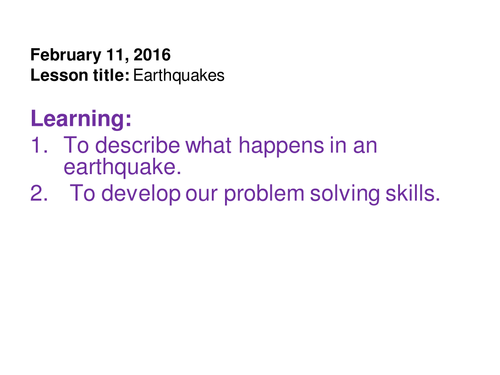
A complete lesson with resources on the nature of earthquakes and their destruction. The first part of the lesson helps students understand the phases of an earthquake and what it feels like to be in an earthquake. The second part of the lesson is a problem solving activity on how to manage the immediate problems after an earthquake.
There is also an AFL activity in the lesson.
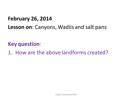
A complete lesson to teach how canyons, wadis and salt pans are formed in arid regions. An interactive lesson which includes a poem, pictures, sketch diagram, video clips and GIS.