

24Uploads
220Views
0Downloads
Geography

KS2 Geography: How Are Mountains Formed?
This ready-to-use lesson resource explores how and where mountains are formed, ideal for Key Stage 2 learners studying physical geography. It provides clear, structured teaching on tectonic plates and mountain types, with interactive and accessible content.
What’s included:
Engaging PowerPoint slides explaining tectonic plates, plate boundaries, and different types of mountains.
Retrieval practice activities to reinforce key vocabulary and understanding of Earth’s structure.
“Who is correct?” reasoning task to encourage critical thinking and explanation skills.
Gap-fill task using key terms like “crust”, “tectonic plates”, and “slowly” to support sentence construction and scientific language.
Focus on fold mountains, clearly linking tectonic activity to mountain formation.
Includes continent names and mapping context to broaden geographical understanding.

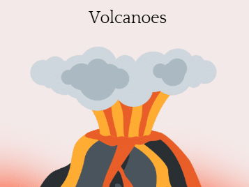
KS2 Geography: Why and Where Do We Get Volcanoes?
This fully resourced lesson pack introduces children to volcanoes—how they form, where they are found, and the different types. Perfect for lower KS2, this lesson supports understanding of plate tectonics and volcano classification in an accessible, engaging way.
Included in this pack:
Clear explanations of tectonic plates, plate boundaries, and volcanic mountain formation.
Retrieval task: “Here’s the answer… what was the question?” activity to deepen thinking and link cause and effect.
Compare and contrast activity for shield vs. composite volcanoes using diagrams and key features.
Geography link to the “Ring of Fire” and global volcanic locations.
Independent research task using child-friendly websites like Kiddle to explore types of volcanoes.
Key vocabulary and visual supports to scaffold learning.

KS2 Geography: What Are the Effects of a Volcanic Eruption?
his comprehensive and thought-provoking lesson pack explores the positive and negative effects of living near volcanoes. Designed for lower KS2 pupils, it balances factual learning with enquiry and empathy, helping children evaluate human choices and environmental impact.
Included:
Clear explanations of key vocabulary: active, dormant, extinct volcanoes.
Case studies featuring real volcanoes and population data (e.g. Mount Vesuvius, Hainan, Dieng Complex) to give global context.
Pros and cons activity: children explore benefits like fertile soil, tourism, geothermal energy, and jobs vs. dangers such as tsunamis, forest fires, and loss of life.
Discussion and reflection tasks such as “Which reason is most significant and why?” to promote deeper thinking.
Retrieval and vocabulary support to reinforce prior learning about volcanoes and tectonic activity.

KS2 Geography: Layers of the Earth
This engaging and fully-prepared lesson resource focuses on the structure of the Earth, ideal for lower Key Stage 2 students. Designed to be clear, interactive, and accessible, this pack includes:
Detailed slides explaining the four layers of the Earth (crust, mantle, outer core, inner core) using child-friendly language.
Retrieval activities to activate prior knowledge and promote deeper thinking.
Visual aids and labelling tasks to support understanding of tectonic plates, magma, and Earth’s composition.
‘What am I?’ quiz questions to consolidate learning and boost recall in a fun, engaging format.
Useful vocabulary and numbers highlighted to build subject-specific language and numeracy skills.

KS2 Geography: What Are Earthquakes?
This structured and informative lesson introduces lower Key Stage 2 pupils to earthquakes: what they are, how they form, and their impact on people and the environment. Perfect for linking physical geography with real-world natural hazards.
Included in this lesson pack:
Clear explanations of tectonic plates, fault lines, seismic waves, focus, and epicentre.
Tsunami connection explained clearly, showing the link between undersea quakes and coastal effects.
Differentiated information texts (standard and simplified versions) for accessibility and comprehension.
Retrieval & reflection questions such as:
What causes earthquakes?
What is the difference between the focus and epicentre?
Which is the worst effect for humans, and why?
Visual aids and vocabulary banks to support learners in using scientific terms accurately.
Discussion and reasoning tasks to promote deeper thinking and class debate.
Bundle
Geography - Volcanoes
This comprehensive Geography unit focuses on volcanoes, mountains, and earthquakes, aligned with the National Curriculum. It includes five fully resourced lessons, complete with slides and accompanying tasks.
By the end of the unit, pupils working at the expected standard will be able to:
Identify and name the four layers of the Earth in the correct order, providing one key fact about each layer.
Describe at least one process by which mountains are formed.
Name a mountain range and identify the continent in which it is located.
Define tectonic plates and explain how mountain ranges are associated with plate boundaries.
Accurately label the key features of shield and composite volcanoes, and explain how each type is formed.
Identify three different ways volcanoes can be classified.
Describe how volcanic activity occurs at tectonic plate boundaries.
Evaluate both the positive and negative impacts of living near a volcano.
Form and justify a personal opinion on whether they would choose to live near a volcano.
Explain that earthquakes result from movements along tectonic plate boundaries.
Understand that earthquakes occur at plate boundaries and describe their effects.
List several potential negative impacts of earthquakes on communities.