I've worked in primary teaching for over 10 years and specialise in creating fun and engaging educational resources, particularly for Geography and History.
I've worked in primary teaching for over 10 years and specialise in creating fun and engaging educational resources, particularly for Geography and History.
This lesson is part of a wider unit called Exploring St Lucia and is designed to teach KS2 students about a contrasting non-European country.
The presentation explores the main geographical features of St Lucia and asks students to categorise these into human and physical.
The activity then challenges students to identify these features on a map of St Lucia. It is differentiated three ways:
Easier – Students identify human & physical features of St Lucia (with clues)
Medium – Students identify human & physical features of St Lucia (no clues)
Harder – Students identify human & physical features of St Lucia (no clues and students also have to draw arrows)
If you like this resource, we would appreciate a review! We will happily send you a free resource in return for a review or useful suggestions/feedback. Contact us at ed@teachitforward.co.uk.
This lesson is part of Understanding Trade, a Geography unit designed for students in upper KS2 (Y5-6).
First the presentation helps students understand what trade is and introduces the concepts of imports and exports. It does this by linking these ideas to every day products we buy. It also looks at the different scales of trade – local, national and international.
The activity then challenges students to match up products with statements about the company which makes them and where they are produced/manufactured.
Easier – Match the products to the statements (on stickers)
Harder – Match the products to the statements (written)
Extension – Students complete a cloze procedure paragraph about trade.
If you like this resource, we would appreciate a review! We will happily send you a free resource in return for a review or useful suggestions/feedback. Contact us at ed@teachitforward.co.uk.
This is the free planning overview for Investigating Rivers, a comprehensive Geography unit about rivers. A topic title page is also included.
This unit is designed for students in KS2 from Y4 to Y6 and includes a variety of engaging lessons, differentiated activities and worksheets.
All the resources described in this unit plan are available on TES either as individual lessons or as a bundle. Lessons include:
L1 - Understanding the water cycle
L2 - Identifying features of a river system
L3 - Identifying characteristics of the three stages of a river
L4 - Investigating features of the River Thames
L5 - Thinking about the different ways we use water
L6 - Understanding the impacts of floods and droughts
If you like this resource, we would appreciate a review! We will happily send you a free resource in return for a review or useful suggestions/feedback. Contact us at ed@teachitforward.co.uk.
This lesson is part of Exploring Brazil, a Geography unit designed for students in KS2 (Y4-6), but can also be taught as a stand alone lesson.
It is a great introduction to using 6-figure grid references. The presentation first recaps how to find 4-figure grid references, then demonstrates how to find 6-figure grid references step by step.
There are two activities:
Activity 1:
Students locate 16 Brazilian cities using 4-figure grid references.
Extension – Students answer questions involving grid references and compass directions.
Activity 2:
Students have a go at describing the location of Brazilian cities more precisely using 6-figure grid references.
Easier – Students use mini-grids to help them locate 16 cities using 6-figure grid references.
Medium – Students use mini-grids to locate 8 cities, then estimate 6-figure grid references for 8 more cities.
Harder – Students have to estimate 6-figure grid references for all 16 cities (i.e. no mini-grids).
If you like this resource, we would appreciate a review! We will happily send you a free resource in return for a review or useful suggestions/feedback. Contact us at ed@teachitforward.co.uk.
This lesson is part of Mountain Environments, a Geography unit designed for students in upper KS2 (Y4-6).
First the presentation looks at features of a mountain climate including lower temperatures and increased rainfall. It then focuses in more detail on the climate of Mount Everest.
There are two activities:
Interpreting climate graphs
In this activity students look at and answer questions about temperature graphs for both the summit and base camp of Mount Everest. It is differentiated two ways:
Easier – Students answer questions about temperature graphs for Mount Everest (suitable for Year 4 and 5).
Harder – Students answer questions about temperature graphs for Mount Everest (suitable for Year 6).
Creating a climate graph in Excel
In this ICT activity, students create their own climate graph, including temperature and rainfall, for the summit of Mount Everest using Microsoft Excel.
If you like this resource, we would appreciate a review! We will happily send you a free resource in return for a review or useful suggestions/feedback. Contact us at ed@teachitforward.co.uk.
This lesson is part of Exploring Spain, a Geography unit designed for upper KS2 students (Y4-6), but can also be taught as a stand alone lesson.
The presentation first shows students how to work out a 4-figure grid reference.
The activity then challenges students to describe the position of different cities in Spain using 4-figure grid references. It is differentiated two ways:
Easier – Students locate Spanish cities using 4-figure grid references (with clues).
Harder – Students locate Spanish cities using 4-figure grid references.
Extension – Students identify Spanish cities using compass direction and grid reference clues.
If you like this resource, we would appreciate a review! We will happily send you a free resource in return for a review or useful suggestions/feedback. Contact us at ed@teachitforward.co.uk.
This lesson is part of Mountain Environments, a Geography unit designed for students in upper KS2 (Y4-6).
First the presentation introduces some of the most famous mountain ranges from around the world.
The differentiated activity then challenges students to locate the world’s mountain ranges and encourages them to use and explore atlases. It is recommended that students do the activity in pairs.
Easier – Students identify the world’s famous mountain ranges (less writing).
Medium – Students identify the world’s famous mountain ranges (first letter clues)
Harder – Students identify the world’s famous mountain ranges (no clues)
If you like this resource, we would appreciate a review! We will happily send you a free resource in return for a review or useful suggestions/feedback. Contact us at ed@teachitforward.co.uk.
The Seaside is a Geography unit designed for students in upper KS1 and lower KS2 (Y2-Y3).
The planning overview, topic title page and vocabulary page can be downloaded for free here. Lessons include:
L1 – Identifying features of the seaside
L2 – Identifying human and physical features of the seaside
L3 – Locating seaside towns and cities of the UK
L4 – Investigating a seaside town - Lyme Regis
L5 – Identifying islands of the United Kingdom
L6 – Investigating what life is like on a small island
L7 - Packing for a seaside holiday
Each lesson includes a presentation and differentiated activities/worksheets.
If you like this resource, we would appreciate a review! We will happily send you a free resource in return for a review or useful suggestions/feedback. Contact us at ed@teachitforward.co.uk.
Understanding Latitude and Longitude is a Geography unit designed for students in upper KS2 and KS3.
The unit contains a sequence of four lessons which are carefully designed to help students understand the key concepts of latitude and longitude and learn the skill of reading coordinates on a world map.
The planning overview and topic title page can be downloaded for free here. Lessons include:
L1 – Introduction to latitude and longitude
L2 – Finding latitude and longitude coordinates on a world map
L3 – Reading latitude and longitude with greater accuracy
L4 – Locating world capital cities using latitude and longitude
Each lesson includes a presentation and differentiated activities/worksheets.
If you like this resource, we would appreciate a review! We will happily send you a free resource in return for a review or useful suggestions/feedback. Contact us at ed@teachitforward.co.uk.
Exploring the UK is a Geography unit suitable for KS1 and lower KS2 (Y2-4).
The planning overview, topic title page and vocabulary page can be downloaded for free here. Lessons include:
L1 – Identifying the countries and capitals of the UK & Ireland (FREE)
L2 – Locating UK cities using compass directions
L3 – Identifying human & physical features of the UK
L4 – Investigating satellite photos of the UK
L5 – Comparing the city and the countryside
L6– Identifying famous features and characteristics of countries of the UK
L7 – Identifying flags of the United Kingdom
L8 – Identifying the four seasons of weather in the UK
Optional lesson – Identifying the countries and capital cities of Europe
Each lesson includes a presentation and differentiated activities/worksheets.
If you like this resource, we would appreciate a review! We will happily send you a free resource in return for a review or useful suggestions/feedback. Contact us at ed@teachitforward.co.uk.
This is a simple matching activity to help children recognise and identify the continents of the world. It is suitable for children in KS1 & KS2.
This resource works well with the World map jigsaw and Continents and oceans of the world.
It can also be used to play Pelmanism, a fun game which promotes concentration and memory skills.
If you like this resource, we would appreciate a review! We will happily send you a free resource in return for a review or useful suggestions/feedback. Contact us at ed@teachitforward.co.uk.
This lesson is part of a wider cross-curricula unit called London Zoo which is designed for KS1 and lower KS2 students (Y2-4).
The engaging presentation takes students on a journey through the main events in the London Zoo’s history, from its founding by Sir Stamford Raffles to the arrival of Winnie the bear (the inspiration for Winnie the Pooh) and also more recent developments such as the opening of Tiger Territory.
The timeline activity reinforces this learning by encouraging students to place these events in chronological order. It is differentiated three ways:
Easier – Students place 8 events on the timeline (using stickers)
Medium – Students write 8 events on a timeline with dates
Harder – Students write 8 events on a timeline without dates
N.B. It is recommended that the activity sheets are photocopied to A3 size to fit the stickers and allow for children with larger handwriting.
If you like this resource, we would appreciate a review! We will happily send you a free resource in return for a review or useful suggestions/feedback. Contact us at ed@teachitforward.co.uk.
This lesson is part of a wider cross-curricula unit called London Zoo which is designed for KS1 and lower KS2 students (Y2-4).
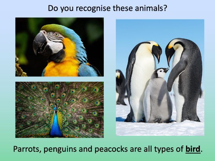
The colourful presentation introduces students to some of the animal groups children might see at London Zoo including mammals, fish, insects, birds, reptiles and amphibians.
The activity then takes students on a tour of the zoo and challenges them to record the animals they would see at different points in their journey. It is differentiated two ways:
Easier – Students identify 20 different animals (with first-letter clues).
Harder – Students identify 20 different animals (no clues).
N.B. The activity worksheet can be photocopied to A3 size to allow for children with larger handwriting.
If you like this resource, we would appreciate a review! We will happily send you a free resource in return for a review or useful suggestions/feedback. Contact us at ed@teachitforward.co.uk.
This lesson is part of a wider cross-curricula unit called London Zoo which is designed for KS1 and lower KS2 students (Y2-4).
The animals have escaped at the zoo and the keeper needs your help! The presentation first encourages students to describe the features of animals. It then challenges students to match animals to their names, description and habitat. It includes a variety of animals including fish, birds, mammals, insects and amphibians.
There is a group activity and an individual activity:
Group Activity:
Students match animals to their names, description and habitat (KS1 and KS2 versions).
Individual Activity:
Students match animals to their names, description and habitat on a worksheet. This is differentiated three ways:
Easier – Students match animals to their habitats.
Medium – Students match animals to their description and habitat.
Harder – Students fill in the names of the animals and match them to their description and habitat.
Extension – Students classify animals as fish, birds, mammals, insects or amphibians.
If you like this resource, we would appreciate a review! We will happily send you a free resource in return for a review or useful suggestions/feedback. Contact us at ed@teachitforward.co.uk.
This lesson is part of a wider cross-curricula unit called London Zoo which is designed for KS1 and lower KS2 students (Y2-4).
The engaging presentation first introduces students to compass directions. It then challenges them to describe the location of animals at London Zoo using north, east, south and west.
In the activity, students describe the position of animals at London Zoo using compass directions. It is differentiated two ways:
Easier – Students have colour coded questions so they can locate animals quickly.
Harder – Students have to find the animals themselves.
Extension – Students are challenged to state the position of animals in relation to other animals (e.g. The owls are north of the gibbons).
If you like this resource, we would appreciate a review! We will happily send you a free resource in return for a review or useful suggestions/feedback. Contact us at ed@teachitforward.co.uk.
This lesson is part of a wider cross-curricula unit called London Zoo which is designed for KS1 and lower KS2 students (Y2-4).
The presentation first introduces students to grid references. It then challenges them to give grid references for animals on a map of London Zoo.
In the activity, students are challenged to describe the position of animals at London Zoo using grid references. It is differentiated two ways:
Easier – Students have six colour coded questions so they can locate animals easily.
Harder – Students have to find the animals themselves.
Extention – Students find the grid references of other locations at the zoo (e.g. the gift shop).
If you like this resource, we would appreciate a review! We will happily send you a free resource in return for a review or useful suggestions/feedback. Contact us at ed@teachitforward.co.uk.
This lesson is part of a wider Geography unit called Great Missenden – A Village Settlement which is designed for students in upper KS2 (Y4-6).
This lesson is the last in the unit and is ideally done after the fifth lesson – Surveying Great Missenden High Street using Google Street View.
The presentation briefly outlines the RICEPOTS system for categorising land use. It then introduces students to a survey map showing land use in Great Missenden High Street.
The activity challenges students to interpret information from the survey. In the extension activity students complete a bar chart showing land use on Great Missenden High Street.
If you like this resource, we would appreciate a review! We will happily send you a free resource in return for a review or useful suggestions/feedback. Contact us at ed@teachitforward.co.uk.
This is the free planning overview for Understanding Latitude & Longitude. A topic title page is also included.
This Geography unit is designed for students in upper KS2 and KS3 and contains a sequence of four lessons with differentiated activities and worksheets. These are carefully designed to help students learn the skill of reading latitude and longitude coordinates on a world map.
All the resources described in this unit plan are available on TES, either as individual lessons or as a bundle. Lessons include:
L1 – Introduction to latitude and longitude
L2 – Finding latitude and longitude coordinates on a world map
L3 – Reading latitude and longitude with greater accuracy
L4 – Locating world capital cities using latitude and longitude
If you like this resource, we would appreciate a review! We will happily send you a free resource in return for a review or useful suggestions/feedback. Contact us at ed@teachitforward.co.uk.
This lesson is part of a wider Geography unit called Great Missenden – A Village Settlement which is designed for students in upper KS2 (Y4-6).
First the presentation introduces students to satellite photos. It then challenges them to use their detective skills to identify various human and physical geographical features in and around Great Missenden.
In the writing activity, students try to identify features in satellite photos of Great Missenden, explaining the reasoning behind their ideas. It is differentiated three ways:
Easier – Student identify one feature in each satellite photo.
Medium – Student identify two features in each satellite photo.
Harder – Student identify three features in each satellite photo.
Extension - Students sort the features they have found in the satellite photos into human and physical geographical features.
If you like this resource, we would appreciate a review! We will happily send you a free resource in return for a review or useful suggestions/feedback. Contact us at ed@teachitforward.co.uk.
This lesson is part of a wider Geography unit called Great Missenden – A Village Settlement which is designed for students in upper KS2 (Y4-6).
The presentation introduces students to the concept of settlements and asks them to categorise them by size (e.g. hamlet, village, town, city, conurbation). It then introduces them to a range of human geographical features found in settlements (e.g. post offices, sports stadiums).
In the activity students identify a variety of human geographical features found in settlements. It is differentiated two ways:
Easier – Students identify the features of settlements with normal clues.
Harder – Students identify the features of settlements with jumbled up clues.
Extension – Students identify which types of settlements these features are usually found in.
If you like this resource, we would appreciate a review! We will happily send you a free resource in return for a review or useful suggestions/feedback. Contact us at ed@teachitforward.co.uk.