

**Remote Sensing: how satellite images are made
(1972-date) **
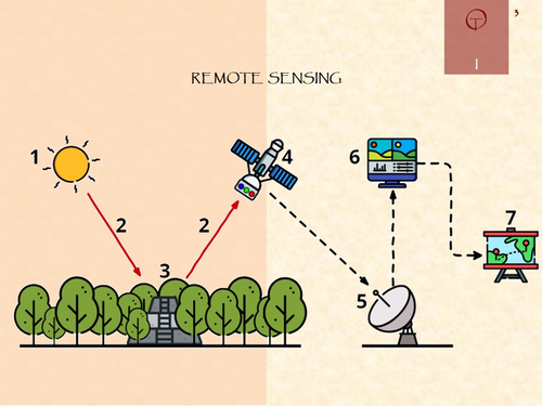
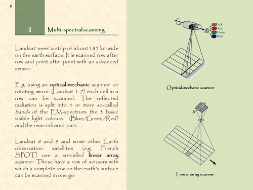
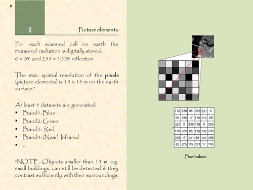
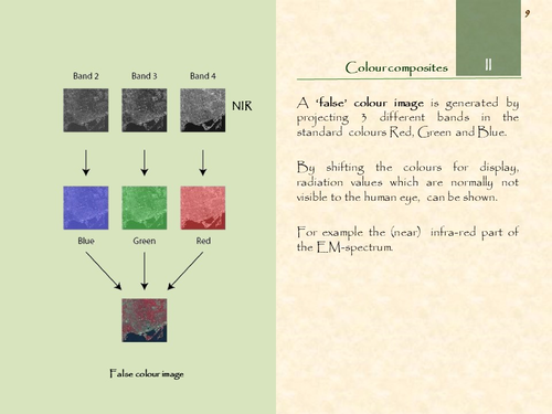
This concise presentation (16 pages) shows how satellite images are generated. It focuses on Landsat, the longest running project for earth observation. The entire process is explained: from the reflected sunbeams on the earth surface to the colours on the screen.
Something went wrong, please try again later.
This resource hasn't been reviewed yet
To ensure quality for our reviews, only customers who have downloaded this resource can review it
to let us know if it violates our terms and conditions.
Our customer service team will review your report and will be in touch.
ÂŁ0.00