51ºÚÁÏ

Last updated

2 January 2024

docx, 1.97 MB
docx, 1.97 MB
pptx, 9.71 MB
pptx, 9.71 MB

Students will be able to describe the route the Amazon river takes using longitude, latitude and countries, then students will be asked to identify confluences, tributaries and other physical features associated with rivers. Next students will be asked to knowledge dump everything they can remember about the water cycle in their books and then match up the labels with the correct definition. Finally students will learn about convectional rainfall and asked to describe the water cycle in the amazon through everything they have learned.

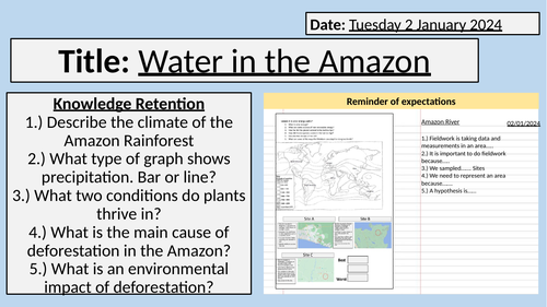
Starter: Knowledge Retention of previous learning
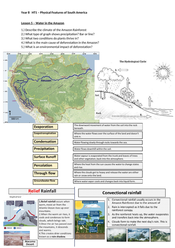
Task 1: Describe the path of the Amazon river from source to mouth.
Task 2: Knowledge dump everything you know about the water cycle.
Task 3: match the correct word to the definition.
Task 4: Main Task: Describe the water cycle that occurs in the Amazon, then explain how this causes convectional rainfall in the Amazon rainforest.
Task 5: Plenary: Recap of home learning expectation.

Lesson contains one powerpoint and one worksheet.

Get this resource as part of a bundle and save up to 40%

A bundle is a package of resources grouped together to teach a particular topic, or a series of lessons, in one place.

Bundle

Physical Features of South America

For KS3 geography, this bundle is great for Year 8 in their first term back at school. This helps to get students familiar again with physical geographical concepts of rivers, coasts, climate. This bundle also contains a tutorial on GIS mapping for students to have a go mapping South America to see its physical features. This bundle contains 7 lessons that are fully resourced, with powerpoints and worksheets. Throughout the series of lessons, students will firstly begin by using GIS to map the physical features of South America and identify its location globally as well as its individual countries. Then students will go through the climate of South America along with creating a climate graph and manipulating and using data. Next students will recap the water cycle, transportation and erosion to learn about meander and waterfall formation, specifically in the case study of the Amazon River. Finally students learn about how headlands, bays and sea stacks formation along the South American coastline. Lesson 1: Mapping South America using GIS Lesson 2: Climate of South America Lesson 3: Amazon Rainforest Characteristics Lesson 4: Deforestation in the Amazon Lesson 5: Water in the Amazon Lesson 6: The Amazon River Lesson 7: Coasts of Brazil Students will gain a variety of skills such as data collection and manipulation along with creation of graphs and reading OS maps. This bundle contains fully resourced lessons along with worksheets.

£8.30

Reviews

Something went wrong, please try again later.

This resource hasn't been reviewed yet

To ensure quality for our reviews, only customers who have purchased this resource can review it

to let us know if it violates our terms and conditions.
Our customer service team will review your report and will be in touch.