


Help your students develop essential map-reading and geographical knowledge with this engaging, fully resourced lesson pack. Designed for KS2 learners, this activity guides pupils in using an atlas to locate countries and identify both human and physical geographical features across the globe.
What’s Included:
- Fully editable ActivInspire flipchart slides (PDF included).
- Slides introducing key concepts with questions and video links
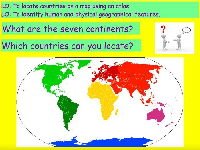
- Atlas-based task sheet prompting students to explore seven countries (including the UK, China, and Brazil), to complete using atlases or digital maps
- Definition guide for human vs physical features
- Plenary discussion activity to consolidate learning
Key Features:
- Promotes independent research skills using atlases or online sources.
- Builds locational knowledge and geography vocabulary
- Editable Word and ActivInspire flipchart – easy to customise.
- Supports UK National Curriculum geography objectives
- Ideal for KS2, with cross-curricular applications in ICT and literacy
Perfect for:
- Geography skills lessons
- Map reading and atlas work
- Used as part of the IPC (International Primary Curriculum) unit 'What’s On The Menu?
- Whole-class activities or small group research
- Cover lessons, enrichments or homework projects
Something went wrong, please try again later.
This resource hasn't been reviewed yet
To ensure quality for our reviews, only customers who have purchased this resource can review it
to let us know if it violates our terms and conditions.
Our customer service team will review your report and will be in touch.
ÂŁ3.00