
326Uploads
21k+Views
146Downloads
All resources

US State Study Guide Worksheets on Illinois
Introducing the “US State Study Guide Worksheets: Illinois” – an engaging and educational printable PDF resource designed to enhance students’ understanding of the geography, history, and socio-economic fabric of Illinois. Perfect for middle and high school students (Grades 7–12), this set of two printable worksheets + teacher resource is ideal for Geography, US History, and Social Studies classrooms.
Whether you’re creating a comprehensive state-by-state unit or diving deep into Illinois specifically, this ready-to-use Illinois Study Guide offers a well-rounded approach to learning.
2 High-Quality Printable PDF Worksheets: These worksheets include multiple activities designed to stimulate critical thinking, promote research, and build foundational knowledge of Illinois. Each activity aligns with common curriculum standards and is ideal for in-class or homework use.
QR Code Linked to Illinois on Google Maps: Let students visualize Illinois exact geographical location with a scannable QR code that links directly to its position on Google Maps. This feature supports digital interactivity and geographic awareness.
In this “US State Study Guide Worksheets on Illinois”, you can find:
• General Information Overview: Students answer key questions about Illinois’s population, area, state symbols, and other vital stats, building their knowledge through fact-finding.
• Etymology of the State Name: Explore the roots of the name Illinois examining its origins and linguistic history. A great cross-disciplinary link to language and culture.
• Geography Challenge: Identify and label Illinois bordering states, analyze its physical terrain, and explore its climate zones. This reinforces regional geography and spatial awareness.
• Economy Exploration: Dive into the economic profile of the state
• Historical Timeline: A blank timeline template is included for students to add major events from Illinois rich historical legacy
• Capital City Spotlight: Investigate Illinois capital—its historical significance, cultural institutions, tourist sites, and more.
• Other Major Cities Activity: Students research and list 5 major cities in Illinois

US State Study Guide Worksheets on Indiana
Introducing the “US State Study Guide Worksheets: Indiana” – an engaging and educational printable PDF resource designed to enhance students’ understanding of the geography, history, and socio-economic fabric of Indiana. Perfect for middle and high school students (Grades 7–12), this set of two printable worksheets + teacher resource is ideal for Geography, US History, and Social Studies classrooms.
Whether you’re creating a comprehensive state-by-state unit or diving deep into Indiana specifically, this ready-to-use Indiana Study Guide offers a well-rounded approach to learning.
2 High-Quality Printable PDF Worksheets: These worksheets include multiple activities designed to stimulate critical thinking, promote research, and build foundational knowledge of Indiana. Each activity aligns with common curriculum standards and is ideal for in-class or homework use.
QR Code Linked to Indiana on Google Maps: Let students visualize Indiana exact geographical location with a scannable QR code that links directly to its position on Google Maps. This feature supports digital interactivity and geographic awareness.
In this “US State Study Guide Worksheets on Indiana”, you can find:
• General Information Overview: Students answer key questions about Indiana’s population, area, state symbols, and other vital stats, building their knowledge through fact-finding.
• Etymology of the State Name: Explore the roots of the name Indiana examining its origins and linguistic history. A great cross-disciplinary link to language and culture.
• Geography Challenge: Identify and label Indiana bordering states, analyze its physical terrain, and explore its climate zones. This reinforces regional geography and spatial awareness.
• Economy Exploration: Dive into the economic profile of the state
• Historical Timeline: A blank timeline template is included for students to add major events from Indiana rich historical legacy
• Capital City Spotlight: Investigate Indiana capital—its historical significance, cultural institutions, tourist sites, and more.
• Other Major Cities Activity: Students research and list 5 major cities in Indiana

US State Study Guide Worksheets on Iowa
Introducing the “US State Study Guide Worksheets: Iowa” – an engaging and educational printable PDF resource designed to enhance students’ understanding of the geography, history, and socio-economic fabric of Iowa. Perfect for middle and high school students (Grades 7–12), this set of two printable worksheets + teacher resource is ideal for Geography, US History, and Social Studies classrooms.
Whether you’re creating a comprehensive state-by-state unit or diving deep into Iowa specifically, this ready-to-use Iowa Study Guide offers a well-rounded approach to learning.
2 High-Quality Printable PDF Worksheets: These worksheets include multiple activities designed to stimulate critical thinking, promote research, and build foundational knowledge of Iowa. Each activity aligns with common curriculum standards and is ideal for in-class or homework use.
QR Code Linked to Iowa on Google Maps: Let students visualize Iowa exact geographical location with a scannable QR code that links directly to its position on Google Maps. This feature supports digital interactivity and geographic awareness.
In this “US State Study Guide Worksheets on Iowa”, you can find:
• General Information Overview: Students answer key questions about Iowa’s population, area, state symbols, and other vital stats, building their knowledge through fact-finding.
• Etymology of the State Name: Explore the roots of the name Iowa examining its origins and linguistic history. A great cross-disciplinary link to language and culture.
• Geography Challenge: Identify and label Iowa bordering states, analyze its physical terrain, and explore its climate zones. This reinforces regional geography and spatial awareness.
• Economy Exploration: Dive into the economic profile of the state
• Historical Timeline: A blank timeline template is included for students to add major events from Iowa rich historical legacy
• Capital City Spotlight: Investigate Iowa capital—its historical significance, cultural institutions, tourist sites, and more.
• Other Major Cities Activity: Students research and list 5 major cities in Iowa

US State Study Guide Worksheets on Hawaii
Introducing the “US State Study Guide Worksheets: Hawaii” – an engaging and educational printable PDF resource designed to enhance students’ understanding of the geography, history, and socio-economic fabric of Hawaii. Perfect for middle and high school students (Grades 7–12), this set of two printable worksheets + teacher resource is ideal for Geography, US History, and Social Studies classrooms.
Whether you’re creating a comprehensive state-by-state unit or diving deep into Hawaii specifically, this ready-to-use Hawaii Study Guide offers a well-rounded approach to learning.
2 High-Quality Printable PDF Worksheets: These worksheets include multiple activities designed to stimulate critical thinking, promote research, and build foundational knowledge of Hawaii. Each activity aligns with common curriculum standards and is ideal for in-class or homework use.
QR Code Linked to Hawaii on Google Maps: Let students visualize Hawaii exact geographical location with a scannable QR code that links directly to its position on Google Maps. This feature supports digital interactivity and geographic awareness.
In this “US State Study Guide Worksheets on Hawaii”, you can find:
• General Information Overview: Students answer key questions about Hawaii’s population, area, state symbols, and other vital stats, building their knowledge through fact-finding.
• Etymology of the State Name: Explore the roots of the name Hawaii examining its origins and linguistic history. A great cross-disciplinary link to language and culture.
• Geography Challenge: Identify and label Hawaii’s bordering states, analyze its physical terrain, and explore its climate zones. This reinforces regional geography and spatial awareness.
• Economy Exploration: Dive into the economic profile of the state
• Historical Timeline: A blank timeline template is included for students to add major events from Hawaii rich historical legacy
• Capital City Spotlight: Investigate Hawaii’s capital—its historical significance, cultural institutions, tourist sites, and more.
• Other Major Cities Activity: Students research and list 5 major cities in Hawaii

US State Study Guide Worksheets on "Florida"
Introducing the “US State Study Guide Worksheets: Florida” – an engaging and educational printable PDF resource designed to enhance students’ understanding of the geography, history, and socio-economic fabric of Florida. Perfect for middle and high school students (Grades 7–12), this set of two printable worksheets + teacher resource is ideal for Geography, US History, and Social Studies classrooms.
Whether you’re creating a comprehensive state-by-state unit or diving deep into Florida specifically, this ready-to-use Florida Study Guide offers a well-rounded approach to learning.
2 High-Quality Printable PDF Worksheets: These worksheets include multiple activities designed to stimulate critical thinking, promote research, and build foundational knowledge of Florida. Each activity aligns with common curriculum standards and is ideal for in-class or homework use.
QR Code Linked to Florida on Google Maps: Let students visualize Florida exact geographical location with a scannable QR code that links directly to its position on Google Maps. This feature supports digital interactivity and geographic awareness.
In this “US State Study Guide Worksheets on Florida”, you can find:
• General Information Overview: Students answer key questions about Florida’s population, area, state symbols, and other vital stats, building their knowledge through fact-finding.
• Etymology of the State Name: Explore the roots of the name Florida examining its origins and linguistic history. A great cross-disciplinary link to language and culture.
Florida
• Geography Challenge: Identify and label Florida’s bordering states, analyze its physical terrain, and explore its climate zones. This reinforces regional geography and spatial awareness.
• Economy Exploration: Dive into the economic profile of the state
• Historical Timeline: A blank timeline template is included for students to add major events from Florida rich historical legacy
• Capital City Spotlight: Investigate Florida’s capital—its historical significance, cultural institutions, tourist sites, and more.
• Other Major Cities Activity: Students research and list 5 major cities in Florida

US State Study Guide Worksheets on "Georgia"
Introducing the “US State Study Guide Worksheets: Georgia” – an engaging and educational printable PDF resource designed to enhance students’ understanding of the geography, history, and socio-economic fabric of Georgia. Perfect for middle and high school students (Grades 7–12), this set of two printable worksheets + teacher resource is ideal for Geography, US History, and Social Studies classrooms.
Whether you’re creating a comprehensive state-by-state unit or diving deep into Georgia specifically, this ready-to-use Georgia Study Guide offers a well-rounded approach to learning.
2 High-Quality Printable PDF Worksheets: These worksheets include multiple activities designed to stimulate critical thinking, promote research, and build foundational knowledge of Georgia. Each activity aligns with common curriculum standards and is ideal for in-class or homework use.
QR Code Linked to Georgia on Google Maps: Let students visualize Georgia exact geographical location with a scannable QR code that links directly to its position on Google Maps. This feature supports digital interactivity and geographic awareness.
In this “US State Study Guide Worksheets on Georgia”, you can find:
• General Information Overview: Students answer key questions about Georgia’s population, area, state symbols, and other vital stats, building their knowledge through fact-finding.
• Etymology of the State Name: Explore the roots of the name Georgia examining its origins and linguistic history. A great cross-disciplinary link to language and culture.
• Geography Challenge: Identify and label Georgia’s bordering states, analyze its physical terrain, and explore its climate zones. This reinforces regional geography and spatial awareness.
• Economy Exploration: Dive into the economic profile of the state
• Historical Timeline: A blank timeline template is included for students to add major events from Georgia rich historical legacy
• Capital City Spotlight: Investigate Georgia’s capital—its historical significance, cultural institutions, tourist sites, and more.
• Other Major Cities Activity: Students research and list 5 major cities in Georgia

US State Study Guide Worksheets on "Connecticut"
Introducing the “US State Study Guide Worksheets: Connecticut” – an engaging and educational printable PDF resource designed to enhance students’ understanding of the geography, history, and socio-economic fabric of Connecticut. Perfect for middle and high school students (Grades 7–12), this set of two printable worksheets + teacher resource is ideal for Geography, US History, and Social Studies classrooms.
Whether you’re creating a comprehensive state-by-state unit or diving deep into Connecticut specifically, this ready-to-use Connecticut Study Guide offers a well-rounded approach to learning.
2 High-Quality Printable PDF Worksheets: These worksheets include multiple activities designed to stimulate critical thinking, promote research, and build foundational knowledge of Connecticut. Each activity aligns with common curriculum standards and is ideal for in-class or homework use.
QR Code Linked to Connecticut on Google Maps: Let students visualize Connecticut exact geographical location with a scannable QR code that links directly to its position on Google Maps. This feature supports digital interactivity and geographic awareness.
In this “US State Study Guide Worksheets on Connecticut”, you can find:
• General Information Overview: Students answer key questions about Connecticut’s population, area, state symbols, and other vital stats, building their knowledge through fact-finding.
• Etymology of the State Name: Explore the roots of the name “Connecticut” examining its origins and linguistic history. A great cross-disciplinary link to language and culture.
• Geography Challenge: Identify and label Connecticut’s bordering states, analyze its physical terrain, and explore its climate zones. This reinforces regional geography and spatial awareness.
• Economy Exploration: Dive into the economic profile of the state
• Historical Timeline: A blank timeline template is included for students to add major events from Connecticuts rich historical legacy
• Capital City Spotlight: Investigate Connecticut’s capital—its historical significance, cultural institutions, tourist sites, and more.
• Other Major Cities Activity: Students research and list 5 major cities in Connecticut

US State Study Guide Worksheets on "Delaware"
Introducing the “US State Study Guide Worksheets: Delaware” – an engaging and educational printable PDF resource designed to enhance students’ understanding of the geography, history, and socio-economic fabric of Delaware. Perfect for middle and high school students (Grades 7–12), this set of two printable worksheets + teacher resource is ideal for Geography, US History, and Social Studies classrooms.
Whether you’re creating a comprehensive state-by-state unit or diving deep into Delaware specifically, this ready-to-use Delaware Study Guide offers a well-rounded approach to learning.
2 High-Quality Printable PDF Worksheets: These worksheets include multiple activities designed to stimulate critical thinking, promote research, and build foundational knowledge of Delaware. Each activity aligns with common curriculum standards and is ideal for in-class or homework use.
QR Code Linked to Delaware on Google Maps: Let students visualize Delaware exact geographical location with a scannable QR code that links directly to its position on Google Maps. This feature supports digital interactivity and geographic awareness.
In this “US State Study Guide Worksheets on Delaware”, you can find:
• General Information Overview: Students answer key questions about Delaware’s population, area, state symbols, and other vital stats, building their knowledge through fact-finding.
• Etymology of the State Name: Explore the roots of the name “Delaware” examining its origins and linguistic history. A great cross-disciplinary link to language and culture.
• Geography Challenge: Identify and label Delaware’s bordering states, analyze its physical terrain, and explore its climate zones. This reinforces regional geography and spatial awareness.
• Economy Exploration: Dive into the economic profile of the state
• Historical Timeline: A blank timeline template is included for students to add major events from Delaware rich historical legacy
• Capital City Spotlight: Investigate Delaware’s capital—its historical significance, cultural institutions, tourist sites, and more.
• Other Major Cities Activity: Students research and list 5 major cities in Delaware

US State Study Guide Worksheets Activity - "Alaska"
Introducing the “US State Study Guide Worksheets: Alaska” – an engaging and educational printable PDF resource designed to enhance students’ understanding of the geography, history, and socio-economic fabric of Alaska. Perfect for middle and high school students (Grades 7–12), this set of two printable worksheets + teacher resource is ideal for Geography, US History, and Social Studies classrooms.
Whether you’re creating a comprehensive state-by-state unit or diving deep into Alaska specifically, this ready-to-use Alaska Study Guide offers a well-rounded approach to learning.
2 High-Quality Printable PDF Worksheets: These worksheets include multiple activities designed to stimulate critical thinking, promote research, and build foundational knowledge of Alaska. Each activity aligns with common curriculum standards and is ideal for in-class or homework use.
QR Code Linked to Alaska on Google Maps: Let students visualize Alaska’s exact geographical location with a scannable QR code that links directly to its position on Google Maps. This feature supports digital interactivity and geographic awareness.
In this “US State Study Guide Worksheets on Alaska”, you can find:
• General Information Overview: Students answer key questions about Alaska’s population, area, state symbols, and other vital stats, building their knowledge through fact-finding.
• Etymology of the State Name: Explore the roots of the name “Alaska” examining its origins and linguistic history. A great cross-disciplinary link to language and culture.
• Geography Challenge: Identify and label Alaska’s bordering states, analyze its physical terrain, and explore its climate zones. This reinforces regional geography and spatial awareness.
• Economy Exploration: Dive into the economic profile of the state
• Historical Timeline: A blank timeline template is included for students to add major events from Alaska’s rich historical legacy
• Capital City Spotlight: Investigate Alaska’s capital—its historical significance, cultural institutions, tourist sites, and more.
• Other Major Cities Activity: Students research and list 5 major cities in Alaska
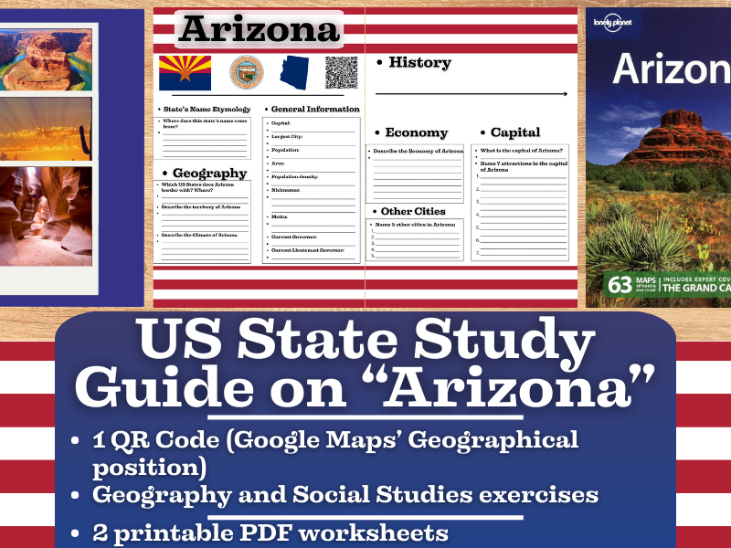
US State Study Guide Worksheets Activity - Arizona
Introducing the “US State Study Guide Worksheets: Arizona” – an engaging and educational printable PDF resource designed to enhance students’ understanding of the geography, history, and socio-economic fabric of Arizona. Perfect for middle and high school students (Grades 7–12), this set of two printable worksheets + teacher resource is ideal for Geography, US History, and Social Studies classrooms.
Whether you’re creating a comprehensive state-by-state unit or diving deep into Arizona specifically, this ready-to-use Arizona Study Guide offers a well-rounded approach to learning.
2 High-Quality Printable PDF Worksheets: These worksheets include multiple activities designed to stimulate critical thinking, promote research, and build foundational knowledge of Arizona. Each activity aligns with common curriculum standards and is ideal for in-class or homework use.
QR Code Linked to Arizona on Google Maps: Let students visualize Arizona exact geographical location with a scannable QR code that links directly to its position on Google Maps. This feature supports digital interactivity and geographic awareness.
In this “US State Study Guide Worksheets on Arizona”, you can find:
• General Information Overview: Students answer key questions about Arizona’s population, area, state symbols, and other vital stats, building their knowledge through fact-finding.
• Etymology of the State Name: Explore the roots of the name “Arizona” examining its origins and linguistic history. A great cross-disciplinary link to language and culture.
• Geography Challenge: Identify and label Arizona’s bordering states, analyze its physical terrain, and explore its climate zones. This reinforces regional geography and spatial awareness.
• Economy Exploration: Dive into the economic profile of the state
• Historical Timeline: A blank timeline template is included for students to add major events from **Arizona’**s rich historical legacy
• Capital City Spotlight: Investigate Arizona’s capital—its historical significance, cultural institutions, tourist sites, and more.
• Other Major Cities Activity: Students research and list 5 major cities in Arizona

US State Study Guide Worksheets Activity - "California"
Introducing the “US State Study Guide Worksheets: California” – an engaging and educational printable PDF resource designed to enhance students’ understanding of the geography, history, and socio-economic fabric of California. Perfect for middle and high school students (Grades 7–12), this set of two printable worksheets + teacher resource is ideal for Geography, US History, and Social Studies classrooms.
Whether you’re creating a comprehensive state-by-state unit or diving deep into California specifically, this ready-to-use California Study Guide offers a well-rounded approach to learning.
2 High-Quality Printable PDF Worksheets: These worksheets include multiple activities designed to stimulate critical thinking, promote research, and build foundational knowledge of California. Each activity aligns with common curriculum standards and is ideal for in-class or homework use.
QR Code Linked to California on Google Maps: Let students visualize California exact geographical location with a scannable QR code that links directly to its position on Google Maps. This feature supports digital interactivity and geographic awareness.
In this “US State Study Guide Worksheets on California", you can find:
• General Information Overview: Students answer key questions about California population, area, state symbols, and other vital stats, building their knowledge through fact-finding.
• Etymology of the State Name: Explore the roots of the name “California”” examining its origins and linguistic history. A great cross-disciplinary link to language and culture.
• Geography Challenge: Identify and label California’ bordering states, analyze its physical terrain, and explore its climate zones. This reinforces regional geography and spatial awareness.
• Economy Exploration: Dive into the economic profile of the state
• Historical Timeline: A blank timeline template is included for students to add major events from California’ s rich historical legacy
• Capital City Spotlight: Investigate California’s capital—its historical significance, cultural institutions, tourist sites, and more.
• Other Major Cities Activity: Students research and list 5 major cities in California

US State Study Guide Worksheets on "Arkansas"
Introducing the “US State Study Guide Worksheets: Arkansas” – an engaging and educational printable PDF resource designed to enhance students’ understanding of the geography, history, and socio-economic fabric of Arkansas. Perfect for middle and high school students (Grades 7–12), this set of two printable worksheets + teacher resource is ideal for Geography, US History, and Social Studies classrooms.
Whether you’re creating a comprehensive state-by-state unit or diving deep into Arkansas specifically, this ready-to-use Arkansas Study Guide offers a well-rounded approach to learning.
2 High-Quality Printable PDF Worksheets: These worksheets include multiple activities designed to stimulate critical thinking, promote research, and build foundational knowledge of Arkansas. Each activity aligns with common curriculum standards and is ideal for in-class or homework use.
QR Code Linked to Arkansas on Google Maps: Let students visualize Arkansas exact geographical location with a scannable QR code that links directly to its position on Google Maps. This feature supports digital interactivity and geographic awareness.
In this “US State Study Guide Worksheets on Arkansas”, you can find:
• General Information Overview: Students answer key questions about Arkansas’ population, area, state symbols, and other vital stats, building their knowledge through fact-finding.
• Etymology of the State Name: Explore the roots of the name “Arkansas” examining its origins and linguistic history. A great cross-disciplinary link to language and culture.
• Geography Challenge: Identify and label Arkansas’ bordering states, analyze its physical terrain, and explore its climate zones. This reinforces regional geography and spatial awareness.
• Economy Exploration: Dive into the economic profile of the state
• Historical Timeline: A blank timeline template is included for students to add major events from Arkansas’ s rich historical legacy
• Capital City Spotlight: Investigate Arkansas’ capital—its historical significance, cultural institutions, tourist sites, and more.
• Other Major Cities Activity: Students research and list 5 major cities in Arkansas

US State Study Guide Worksheets on "Colorado"
Introducing the “US State Study Guide Worksheets: Colorado” – an engaging and educational printable PDF resource designed to enhance students’ understanding of the geography, history, and socio-economic fabric of Colorado. Perfect for middle and high school students (Grades 7–12), this set of two printable worksheets + teacher resource is ideal for Geography, US History, and Social Studies classrooms.
Whether you’re creating a comprehensive state-by-state unit or diving deep into Colorado specifically, this ready-to-use Colorado Study Guide offers a well-rounded approach to learning.
2 High-Quality Printable PDF Worksheets: These worksheets include multiple activities designed to stimulate critical thinking, promote research, and build foundational knowledge of Colorado. Each activity aligns with common curriculum standards and is ideal for in-class or homework use.
QR Code Linked to Colorado on Google Maps: Let students visualize Colorado exact geographical location with a scannable QR code that links directly to its position on Google Maps. This feature supports digital interactivity and geographic awareness.
In this “US State Study Guide Worksheets on Colorado", you can find:
• General Information Overview: Students answer key questions about Colorado population, area, state symbols, and other vital stats, building their knowledge through fact-finding.
• Etymology of the State Name: Explore the roots of the name “Colorado” examining its origins and linguistic history. A great cross-disciplinary link to language and culture.
• Geography Challenge: Identify and label Colorado’s bordering states, analyze its physical terrain, and explore its climate zones. This reinforces regional geography and spatial awareness.
• Economy Exploration: Dive into the economic profile of the state
• Historical Timeline: A blank timeline template is included for students to add major events from Colorado’ s rich historical legacy
• Capital City Spotlight: Investigate Colorado’s capital—its historical significance, cultural institutions, tourist sites, and more.
• Other Major Cities Activity: Students research and list 5 major cities in Colorado

US State Study Guide Worksheets Activity - "Alabama"
Introducing the “US State Study Guide Worksheets: Alabama” – an engaging and educational printable PDF resource designed to enhance students’ understanding of the geography, history, and socio-economic fabric of Alabama. Perfect for middle and high school students (Grades 7–12), this set of two printable worksheets + teacher resource is ideal for Geography, US History, and Social Studies classrooms.
Whether you’re creating a comprehensive state-by-state unit or diving deep into Alabama specifically, this ready-to-use Alabama Study Guide offers a well-rounded approach to learning.
2 High-Quality Printable PDF Worksheets: These worksheets include multiple activities designed to stimulate critical thinking, promote research, and build foundational knowledge of Alabama. Each activity aligns with common curriculum standards and is ideal for in-class or homework use.
QR Code Linked to Alabama on Google Maps: Let students visualize Alabama’s exact geographical location with a scannable QR code that links directly to its position on Google Maps. This feature supports digital interactivity and geographic awareness.
In this “US State Study Guide Worksheets on Alabama”, you can find:
• General Information Overview: Students answer key questions about Alabama’s population, area, state symbols, and other vital stats, building their knowledge through fact-finding.
• Etymology of the State Name: Explore the roots of the name “Alabama” examining its origins and linguistic history. A great cross-disciplinary link to language and culture.
• Geography Challenge: Identify and label Alabama’s bordering states, analyze its physical terrain, and explore its climate zones. This reinforces regional geography and spatial awareness.
• Alabama Economy Exploration: Dive into the economic profile of the state
• Historical Timeline: A blank timeline template is included for students to add major events from Alabama’s rich historical legacy
• Capital City Spotlight: Investigate Alabama’s capital—its historical significance, cultural institutions, tourist sites, and more.
• Other Major Cities Activity: Students research and list 5 major cities in Alabama

Country Study Worksheets on Jamaica - Caribbeans - North America
This Geography + Social Studies Country Study Teaching Resource is a PDF Printable Worksheets Activity on “Jamaica” (Caribbeans). It can be ideal for Geography and Social Studies Classes students at high school and middle school (from 7th grade to 12th grade).
This Teaching Resource on “Jamaica” (Caribbeans) can be ideal to introduce students to this wonderful country in the Caribbeans. Geography topics such as territory, languages spoken, economy, the Capital city, history and culture are dealt in this Social Studies and Geography Worksheets Activity on “Jamaica”
In this Social Studies + Geography Teaching Resource (Country Study Worksheets) on “Jamaica”, teachers can find the following activities:
history questions
exercises on the geography of Jamaica (territory + climate + borders)
1 exercise related to the language spoken (English + Jamaican Patois)
1 exercise on the economy
1 exercise of the cities of Jamaica (listing 5 major cities)
1 exercise on the capital city (listing 7 attractions)
1 exercise on the culture of Jamaica
In this Geography + Social Studies Country Study Worksheets Activity on Jamaica, it is also included a QR Code linked to the geographical position of this Caribbean Country on Google Maps

Country Study Worksheets on "Kiribati" - Oceania
This Geography Social Studies Teaching resource is great for Country Study Activities on Kiribati (Oceania). This Printable Teaching Resource is a 2 pages PDF Worksheet on Kiribati. It can be suitable for Middle School and High School Geography and Social Studies Learners (7th-12th graders). This Teaching Material can be great for testing students on their knowledge on Kiribati and its Culture (basic information + languages + history + geography + economy + Tarawa + culture).
In this Geography, Social Studies Country Study on Kiribati (PDF Printable Worksheets; 2 pages) there are included:
a qr code linked to Kiribati’s position on Google Maps
questions on Geography
questions on History
questions on the Language
questions on the Economy
an exercise where it is asked to list some of **the most famous sights in Tarawa **(Capital)
an exercise where it is asked to list other cities in Kiribati
an exercise where it is asked to write about the Culture of Kiribati
This amazing Social Studies + Geography Country Study on Kiribati (island country) PDF Digital Teaching Resource (2 PDF Printable Slides) can be great for learners from 7th grade to 12th grade to test Kiribati and its Culture.
Social Studies with Alan is a Brand New Teaching Resource, Educational Material Store whose aim is to help Teachers, Educators and Tutors to achieve their teaching objectives while creating a fun and stimulating environment. Learning is Fun. Never Forget!

Country Study Worksheets on Italy - Southern Europe
This Geography Social Studies Teaching resource is great for Country Study Activities on Italy (Southern Europe). This Printable Teaching Resource is a 2 pages PDF Worksheet on Italy. It can be suitable for Middle School and High School Geography and Social Studies Learners (7th-12th graders). This Teaching Material can be great for testing students on their knowledge on Italy and its Culture (basic information + languages + history + geography + economy + Rome + culture).
In this Geography, Social Studies Country Study on Italy (PDF Printable Worksheets; 2 pages) there are included:
a qr code linked to Italy’s position on Google Maps
questions on Geography
questions on History
questions on the Language
questions on the Economy
an exercise where it is asked to list some of the most famous sights in Rome (Capital)
an exercise where it is asked to list other cities in Italy
an exercise where it is asked to write about the Culture of Italy
This amazing Social Studies + Geography Country Study on Italy (Southern Europe) PDF Digital Teaching Resource (2 PDF Printable Slides) can be great for learners from 7th grade to 12th grade to test Italy and its Culture.
Social Studies with Alan is a Brand New Teaching Resource, Educational Material Store whose aim is to help Teachers, Educators and Tutors to achieve their teaching objectives while creating a fun and stimulating environment. Learning is Fun. Never Forget!

Country Study Worksheets on Israel - Middle East
This Geography Social Studies Teaching resource is great for Country Study Activities on Israel (West Asia - Middle East). This Printable Teaching Resource is a 2 pages PDF Worksheet on Israel. It can be suitable for Middle School and High School Geography and Social Studies Learners (7th-12th graders). This Teaching Material can be great for testing students on their knowledge on Israel and its Culture (basic information + languages + history + geography + economy + Jerusalem + culture).
In this Geography, Social Studies Country Study on Israel (PDF Printable Worksheets; 2 pages) there are included:
a qr code linked to Israel’s position on Google Maps
questions on Geography
questions on History
questions on the Language
questions on the Economy
an exercise where it is asked to list some of the most famous sights in Jerusalem (Capital)
an exercise where it is asked to list other cities in Israel
an exercise where it is asked to write about the Culture of Israel
This amazing Social Studies + Geography Country Study on Israel (Middle East) PDF Digital Teaching Resource (2 PDF Printable Slides) can be great for learners from 7th grade to 12th grade to test Israel and its Culture.
Social Studies with Alan is a Brand New Teaching Resource, Educational Material Store whose aim is to help Teachers, Educators and Tutors to achieve their teaching objectives while creating a fun and stimulating environment. Learning is Fun. Never Forget!

Country Study Worksheets on Iraq - Middle East
This Geography Social Studies Teaching resource is great for Country Study Activities on Iraq (West Asia - Middle East). This Printable Teaching Resource is a 2 pages PDF Worksheet on Iraq. It can be suitable for Middle School and High School Geography and Social Studies Learners (7th-12th graders). This Teaching Material can be great for testing students on their knowledge on Iraq and its Culture (basic information + languages + history + geography + economy + Baghdad + culture).
In this Geography, Social Studies Country Study on Iraq (PDF Printable Worksheets; 2 pages) there are included:
a qr code linked to Iraq’s position on Google Maps
questions on Geography
questions on History
questions on the Language
questions on the Economy
an exercise where it is asked to list some of the most famous sights in Baghdad (Capital)
an exercise where it is asked to list other cities in Iraq
an exercise where it is asked to write about the Culture of Iraq
This amazing Social Studies + Geography Country Study on Iraq (Middle East) PDF Digital Teaching Resource (2 PDF Printable Slides) can be great for learners from 7th grade to 12th grade to test Iraq and its Culture.
Social Studies with Alan is a Brand New Teaching Resource, Educational Material Store whose aim is to help Teachers, Educators and Tutors to achieve their teaching objectives while creating a fun and stimulating environment. Learning is Fun. Never Forget!

Country Study Worksheets on Iran - West Asia - Middle Eastt
This Geography Social Studies Teaching resource is great for Country Study Activities on Iran (West Asia; Middle East). This Printable Teaching Resource is a 2 pages PDF Worksheet on Iran. It can be suitable for Middle School and High School Geography and Social Studies Learners (7th-12th graders). This Teaching Material can be great for testing students on their knowledge on Iran and Iranian Culture (basic information + language + history + geography + economy + Tehran + culture).
In this Geography, Social Studies Country Study on Iran (PDF Printable Worksheets; 2 pages) there are included:
a qr code linked to Iran’s position on Google Maps
questions on Geography
questions on History
questions on the Language
questions of the Economy
an exercise where it is asked to list some of the most famous sights in Tehran (Capital)
an exercise where it is asked to list other cities in Iran
an exercise where it is asked to write about the Iranian Culture
This amazing Social Studies + Geography Country Study on Iran (West Asia; Middle East) PDF Digital Teaching Resource (2 PDF Printable Slides) can be great for learners from 7th grade to 12th grade to test Iran and its Culture.
Social Studies with Alan is a Brand New Teaching Resource, Educational Material Store whose aim is to help Teachers, Educators and Tutors to achieve their teaching objectives while creating a fun and stimulating environment. Learning is Fun. Never Forget!