
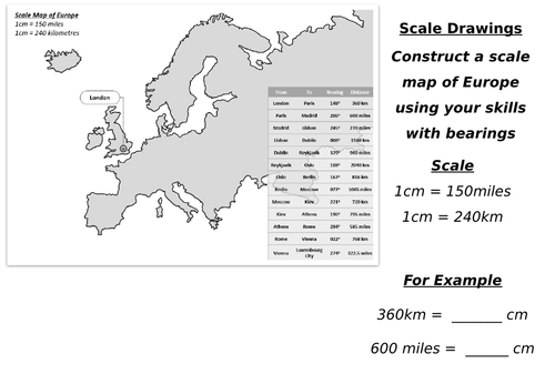
I wanted to make a more interesting scale drawing activity for my higher attaining students to practice using scales and bearings.
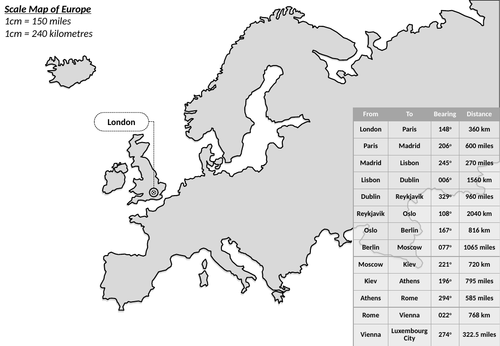
This is a blank map of Europe that the students need to populate with various capital cities using the given bearings and scales.
It is relatively* accurate in how it represents the relationships between the cities, although I would not use it as an atlas.
It is quite a challenging task but I have found the students enjoy giving it a go and it takes up most of the lesson.
It is always interesting to see where the various cities end up - usually Athens get placed in the Mediterranean!
Enjoy.
Something went wrong, please try again later.
Excellent just what i was looking for.
to let us know if it violates our terms and conditions.
Our customer service team will review your report and will be in touch.
ÂŁ0.00