


This PowerPoint and bundle of worksheet materials was used with KS1 classes, both Yr1 and Yr2, but could also be beneficial with EAL pupils and as a refresher for LKS2.
The materials provide an introduction into the countries that make up the UK and were useful when regular opportunities for partner testing and recall was included. The Power Point incorporates simple animation and colour to focus attention on each country when being introduced.
The associated sheets include;
- UK Country Information – This provides a pupil reference sheet for the information contained in the Power Point.
- UK Country Close Procedure – This could be used with the above reference sheet as required, to encourage pupils to record information.
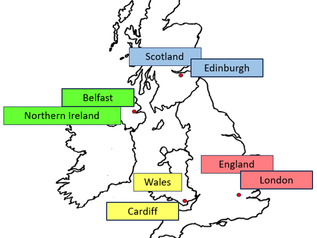
- UK map with dots – This sheet has an outline map of the UK along with dots to identify the location of the capital cities.
- UK map with labels – This sheet allows a further level of differentiation and has an outline map of the UK with dots as above along with label boxes and the starting letter of each capital city.
- UK Towns and Cities – This sheet was used as an extension task where pupils were able to use an atlas to locate other prominent towns and cities and add these to their maps of the UK.
- Country Flags – This sheet gives basic grey outlines of the different country flags and guidance on how to colour them.
Something went wrong, please try again later.
This resource hasn't been reviewed yet
To ensure quality for our reviews, only customers who have purchased this resource can review it
to let us know if it violates our terms and conditions.
Our customer service team will review your report and will be in touch.
ÂŁ2.50